Lineage:
Source_Information:
Source_Citation:
Citation_Information:
Originator: U.S. Geological Survey
Publication_Date: 1970
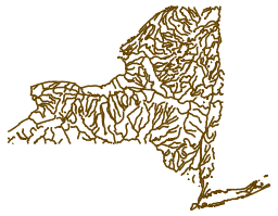
Title: The National Atlas of the United States of America
Geospatial_Data_Presentation_Form: Map
Publication_Information:
Publication_Place: Reston, VA
Publisher: U.S. Geological Survey
Source_Scale_Denominator: 2000000
Type_of_Source_Media: stable-based material
Source_Time_Period_of_Content:
Time_Period_Information:
Single_Date/Time:
Calendar_Date: 1970
Source_Currentness_Reference: Publication Date
Source_Citation_Abbreviation: MAP1
Source_Contribution: Spatial and attribute information
Source_Information:
Source_Citation:
Citation_Information:
Originator: U.S. Geological Survey
Publication_Date: 1979
Title: Landsat imagery
Publication_Information:
Publication_Place: Reston, V.A.
Publisher: U.S. Geological Survey
Other_Citation_Details: This source citation references a source used to revise the published 1:2,000,000-scale National Atlas sectional maps prior to digitization. Individual files within the series may or may not have been altered as a result of this source.
Type_of_Source_Media: Various
Source_Time_Period_of_Content:
Time_Period_Information:
Single_Date/Time:
Calendar_Date: 1979
Source_Currentness_Reference: Publication Date
Source_Citation_Abbreviation: REVHYD1
Source_Contribution: Spatial and attribute information to update streams in Alaska.
Source_Information:
Source_Citation:
Citation_Information:
Originator: National Oceanic and Atmospheric Administration
Publication_Date: 1979
Title: Sectional Aeronautical Charts
Publication_Information:
Publication_Place: Washington, D.C.
Publisher: National Oceanic and Atmospheric Administration
Other_Citation_Details: This source citation references a source used to revise the published 1:2,000,000-scale National Atlas sectional maps prior to digitization. Individual files within the series may or may not have been altered as a result of this source.
Type_of_Source_Media: Various
Source_Time_Period_of_Content:
Time_Period_Information:
Single_Date/Time:
Calendar_Date: 1979
Source_Currentness_Reference: Publication Date
Source_Citation_Abbreviation: REVHYD2
Source_Contribution: Spatial and attribute information to update major reservoirs.
Process_Step:
Process_Description: This file was originally digitized by the National Mapping Division based on the sectional maps contained in The National Atlas of the United States of America published by the USGS in 1970. At the time of digitization in the late 1970s, most of the information contained in the maps was updated, using the latest available source materials. The digital data were produced by manually digitizing from stable-based copy of the graphic material using a digitizing table with a resolution of 0.003 to 0.005 inches. The digital data were checked for position by visually comparing proof plots with the graphic source. The digital data were checked for classification by manually checking proof plots against code listings. This file has undergone digital revision. The digital revision uses ancillary source, with no field verification.
Source_Used_Citation_Abbreviation: MAP1
Source_Used_Citation_Abbreviation: REVHYD1
Source_Used_Citation_Abbreviation: REVHYD2
Process_Date: 1983
Process_Step:
Process_Description: This file was processed from Digital Line Graph (DLG) format packaged using the Spatial Data Transfer Standard (SDTS), into Arc/Info coverage format and then exported into Arc/Info Interchange format (.e00) using Arc/Info ver. 7.1.2. This file was also reprojected from Geographic to Universal Transverse Mercator, with units converted from decimal degrees to meters. No revisions or corrections were made to the data in this conversion process.
Process_Date: 1998