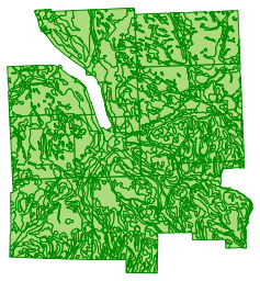
Purpose: Soil associations are groupings of two of three soil types that are considered similar enough, or are commonly found together on the landscape, so as to represent a somewhat uniform set of characteristics. Soil association maps go beyond soil surveys by aggregating soil series into larger geographical areas, thereby allowing more general or broader scale applications.
Supplemental_Information: This data set is meant for general planning purposes only and is not meant to provide information about specific site conditions. For fine scale analysis, a detailed site survey is recommended.
Time_Period_of_Content:
Time_Period_Information:
Single_Date/Time:
Calendar_Date: 1965
Currentness_Reference: publication date
Status:
Progress: Complete
Maintenance_and_Update_Frequency: None planned
Spatial_Domain:
Bounding_Coordinates:
West_Bounding_Coordinate: -76.696267
East_Bounding_Coordinate: -76.23765
North_Bounding_Coordinate: 42.627521
South_Bounding_Coordinate: 42.262465
Keywords:
Theme:
Theme_Keyword_Thesaurus: None
Theme_Keyword: soil survey
Theme_Keyword: soil associations
Theme:
Theme_Keyword_Thesaurus: ISO 19115 Topic Category
Theme_Keyword: environment
Theme_Keyword: geoscientificInformation
Theme:
Theme_Keyword_Thesaurus: CUGIR Category
Theme_Keyword: environment
Theme_Keyword: geology
Place:
Place_Keyword_Thesaurus: None
Place_Keyword: Tompkins County
Access_Constraints: None
Use_Constraints: From the "Tompkins County Soil Interpretation Report": "This Bulletin is designed primarily to provide general soil information to assist in the planning and development of Tompkins County. The general soil map is at a scale of 1:63360. These maps provide information that will help to plan effective use of land areas greater than about 25 acres in the county. For more detailed information, please consult the published soil survey which contains soil maps at a scale 1:20,000. The soil interpretations developed for the selected specific uses, are be [by] necessity, general in nature, and are based on the dominant soil conditions that occur within each delineated soil association area. Larger scale soil maps, showing more detailed soil separations, are needed for the more detailed soil interpretations. On-site evaluations for specific sites, made prior to construction, are needed to determine suitability or limitations of the specific use. Investigations and interpretation apply to a depth of 5 or 6 feet. Soil properties do not function independently of each other. The effect of one property is influenced by other associated properties." The following statement must be included with any products that use or are derived from this data set: Data contained in this product was originally produced by the Tompkins County Planning Department, the Tompkins County ITS GIS Division, and the USDA Soil Conservation Service and may not be reproduced or redistributed without the express written consent of the originators. The originators do not warrant the accuracy or completeness of the information portrayed by the data.
Point_of_Contact:
Contact_Information:
Contact_Organization_Primary:
Contact_Organization: Tompkins County ITS GIS Division
Publisher: US Department of Agriculture, Soil Conservation Service
Cross_Reference:
Citation_Information:
Originator: John A. Neeley
Publication_Date: 1965
Title: Soil Survey, Tompkins County, New York
Publication_Information:
Publication_Place: Washington, DC
Publisher: US Department of Agriculture, Soil Conservation Service
Data_Quality_Information
Attribute_Accuracy:
Attribute_Accuracy_Report: See Entity and Attribute Information
Logical_Consistency_Report: A printout of the final data set was compared to the source map for consistency. During the review, it was found that the digitization was not as accurate as the source map. It was also determined that the source map showed older municipal boundaries for the Villages of Dryden, Trumansburg, and Groton and showed no boundary for the Village of Lansing, which must have been manually drawn-in during the digitization process.
Completeness_Report: Complete coverage for Tompkins County.
Positional_Accuracy:
Horizontal_Positional_Accuracy:
Horizontal_Positional_Accuracy_Report: Original map met federal standards for map accuracy at 1/63360 (1" = 1 mile)
Vertical_Positional_Accuracy:
Vertical_Positional_Accuracy_Report: Original map met federal standards for map accuracy at 1/63360 (1" = 1 mile)
Lineage:
Source_Information:
Source_Citation:
Citation_Information:
Originator: Frank Z. Hutton
Publication_Date: January, 1970
Title: Tompkins County Soil Interpretation Report
Publication_Information:
Publication_Place: Syracuse, NY
Publisher: US Department of Agriculture, Soil Conservation Service
Source_Contribution: Soil descriptions, soil identification process, and source paper map.
Process_Step:
Process_Description: From the "Tompkins County Soil Interpretation Report": "The general soil map was prepared from published and unpublished soil surveys of the National Cooperative Soil Survey in New York State. Agencies responsible for the National Cooperative Soil Survey are the U. S. Department of Agriculture, Soil Conservation Service; and Cornell University Agriculture Experiment Station." The map associated with this report was then digitized using MapGrafix and rectified to the 1991 Tompkins County Digital Planimetric Basemap, presumably using a polynomial rectification process. The MapGrafix data set was then converted to Arc/Info in a three-step process: (1) Polygon outlines were exported to AutoCAD DXF and converted to Arc/Info using the DXFARC command (2) The polygon "centroids" were exported to a comma-delimited text file, then converted to a shapefile in ArcView (3) Attributes for the soil number were added in TABLES, then populated in ArcView using the "centroids" shapefile as a spatial join (point-in-polygon analysis) to the polygon outlines. Regions were then created by using the REGIONDISSOLVE command in Arc/Info with the SOILNUMBER field. Additional attributes for the soil names, categories, and areas were added to the Region and Polygon layers and populated in ArcView.
Process_Contact:
Contact_Information:
Contact_Organization_Primary:
Contact_Organization: Tompkins County Planning Department
Contact_Person: Sharon Heller
Contact_Position: GIS Analyst
Contact_Voice_Telephone: (607) 274-5560
Contact_Facsimile_Telephone: (607) 274-5578
Hours_of_Service: 8:30 - 4:30 Monday to Friday
Process_Step:
Process_Description: CUGIR staff converted to shapefile from Arc/Info .e00 format.
Spatial_Data_Organization_Information
Direct_Spatial_Reference_Method: Vector
Point_and_Vector_Object_Information:
SDTS_Terms_Description:
SDTS_Point_and_Vector_Object_Type: Polygon
Point_and_Vector_Object_Count: 1189
Spatial_Reference_Information
Horizontal_Coordinate_System_Definition:
Planar:
Grid_Coordinate_System:
Grid_Coordinate_System_Name: State Plane Coordinate System 1983
Horizontal_Datum_Name: North American Datum of 1983
Ellipsoid_Name: Geodetic Reference System 80
Semi-major_Axis: 6378206
Denominator_of_Flattening_Ratio: 294.9786982
Entity_and_Attribute_Information
Entity_Type:
Entity_Type_Label: Soil Associations
Entity_Type_Definition: Soil association types in Tompkins County, as defined by Frank Z. Hutton in "Tompkins County Soil Interpretation Report": I. Areas dominated by coarse textured soils with sand and/or gravel substrata (a) Dominantly excessively drained nearly level to rolling soils 1. Colonie-Arkport Association 2. Colonie-Galen Association 3. Colonie-Windsor Association 4. Otisville-Hinckley Association 5. Windsor-Adams Association (b) Dominantly excessively drained hilly to steep slopes 6. Adams-Windsor Association 7. Hinckley-Otisville Association (c) Dominantly somewhat poorly and poorly drained level to very gently sloping soils subject to prolonged wetness and ponding 8. Au Gres-Scarboro Association 9. Stafford-Lamson Association II. Areas dominated by medium and moderately coarse textured soils with sand and/or gravel substrata (a) Dominantly well and moderately well drained level to rolling soils on terrains and deltas not subject to flooding 10. Howard-Arkport Association 11. Alton-Hinckley Association 12. Alton-Otisville Association 13. Alton-Williamson Association 14. Arkport-Colonie Association 15. Galen-Minoa Association 16. Howard Association 116. Howard-Phelps Association 17. Howard-Chenango Association 18. Palmyra-Howard-Unadilla Association 19. Palmyra Association 20. Palmyra-Alton Association 21. Wampsville-Palmyra Association (b) Dominantly well to excessively drained, hilly to steep slopes 22. Palmyra-Alton-Howard Association 23. Palmyra-Arkport Association 24. Howard-Palmyra Association (c) Dominantly well and moderately well drained level to gently sloping soils on bottomlands and alluvial fans, subject to flooding 25. Alluvial land - Tioga fan 26. Hamlin, fan - Palmyra 27. Hamlin-Teel Association 28. Howard-Middlebury-Papkating Association 29. Middlebury-Tioga-Papkating Association (d) Dominantly somewhat poor and poor level soils on deltas not subject to stream flooding 30. Lamson-Minoa Association 31. Lamson-Niagara Association 32. Minoa-Lamson Association 33. Minoa-Niagara Association (e) Dominantly somewhat poor and poorly and very poorly drained level soils on bottomlands subject to flooding 34. Alluvial land - Rumney 35. Minoa-Rumney Association 36. Rumney-Saco Association 37. Papakating - Alluvial land III. Areas dominated by medium and moderately fine textured soils containing fragments with compact calcareous glacial till substrata (a) Dominatly deep, well and moderately well drained, nearly level to sloping soils 40. Cazenovia-Ovid Association 41. Hilton-Appleton Association 42. Honeoye-Lima Association 43. Lansing-Conesus Association 44. Ontario Association 45. Ontario-Hilton Association (b) Dominatly deep, well and moderately well, moderately steep to hilly to very steep slopes 46. Ontario-Honeoye-Lansing Association (c) Dominatly somewhat poor and poorly drained, level to gently sloping soils subject to prolonged wetness 39. Ovid-Ilion Association 47. Appleton-Hilton Association 48. Kendaia-Lyons Association (d) Dominatly deep and moderately deep, well and moderately well, nearly level to sloping soils 49. Camillus-Ontario Association 50. Cazenovia-Aurora Association 51. Mohawk-Palatine Association IV. Areas dominated by medium and moderately coarse textured soils having brittle pans and stone fragments with compact non-calcareous till substrata (a) Dominatly well and moderately well drained nearly level to sloping soils 52. Mardin-Volusia Association 53. Ira-Sodus Association 54. Langford-Erie Association 55. Langford-Howard Association 56. Mardin-Howard Association 57. Mardin-Lordstown Association 58. Sodus-Ira Association 59. Worth-Empeyville Association (b) Dominatly well and moderately well drained, moderately steep to hilly to steep soils 60. Sodus Association 61. Mardin-Langford Association 62. Mardin-Langford-Howard Association (c) Dominately well and moderately well drained, nearly level to sloping very stony soils 63. Worth-Empeyville Association, very stony (d) Dominatly somewhat poorly and poorly drained, level to sloping soils 64. Chippewa-Volusia-Alden Association 65. Ellery-Erie-Alden Association 66. Erie-Langford Association 67. Scriba-Ira Association 68. Volusia-Mardin Association 69. Westbury-Empeyville Association V. Areas dominated by coarse to fine textured stone-free soils with silt or clay, glacial lake and/or alluvial substrata (a) Dominatly well and moderately well drained, nearly level to rolling silty soils 71. Collamer-Dunkirk Association 72. Collamer-Niagara Association 73. Dunkirk-Collamer Association 74. Unadialla-Scio Association 75. Williamson Association 76. Willaimson-Amboy Association (b) Dominatly well and moderately well drained, nearly level to rolling clayey soils 77. Schoharie-Odessa Association 91. Hudson-Rhinebeck Association (c) Dominatly well drained, hilly to steep silty and clayey soils 70. Hudson-Dunkirk Association 78. Schoharie-Dunkirk Association (d) Dominatly somewhat poorly, poorly and very poorly drained level to nearly level soils on glacial lake sediments subject to prolonged wetness and ponding 79. Alden-Canandaigua Association 80. Canandaigua-Niagara Association 81. Cosad-Claverack Association 82. Madalin-Lakemont-Fonda Association 83. Madalin-Rhinebeck Association 84. Rhinebeck-Dunkirk Association 85. Rhinebeck-Madalin Association 86. Wallington-Niagara Association 105. Rhinebeck-Niagara Association (e) Dominatly poorly and very poorly drained, level bottomland soils subject to flooding 87. Sloan-Teel Association - Alluvial land 88. Sloan-Madalin-Fonda Association 89. Warners-Sloan-Muck Association 90. Wayland-Wallington Association VI. Areas dominated by soils containing stone fragments that are moderately deep and shallow to bedrock (a) Dominatly well drained nearly level to sloping soils 92. Benson-Wassaic Association 93. Lordstown-Langford Association 94. Lordstown-Mardin Association 95. Manlius Association 96. Wassaic-Benson Association (b) Dominatly well drained, moderately steep to very steep soils 97. Aurora-Farmington-Manlius Association 98. Farmington-Benson Association 99. Lordstown-Arnot Association 100. Lordstown-Mardin-Langford Association (c) Moderately well and somewhat poorly drained, nearly level to sloping soils 101. Angola-Erie Association 102. Angola-Varick Association 103. Aurora-Angola Association 104. Lairdsville-Brockport Association VII. Area dominated by very poorly drained level organic soils subject to prolonged wetness and ponding 106. Fresh Water Marsh - Muck 107. Muck - Peat VIII. Areas dominated by miscellaneous land types 110. Beaches 111. Made Land 112. Quarries 113. Gravel Pits - large
Entity_Type_Definition_Source: Frank Z. Hutton of the USDA Soil Conservation Service, 1970
Attributes:
Name
Description
Values
AREA
Soil Association Region Area (Internal Software Attribute, in Map Units)
SOIL_NAME
Corresponding soil association name for numeric index value shown on original paper map.
Code
Definition
Aurora-Angola
AURORA soils are moderately deep, moderately well drained medium to moderately fine textured soils that occupy nearly level to strongly sloping bedrock-controlled landforms. Aurora soils have 1 foot of moderately permeable silt loam over 1 to 2 feet of slowly permeable heavy silt loam or light silty clay loam that is underlain by soft, slightly acid or calcareous shale that intergrades to hard limetstone or sandstone in some places. ANGOLA soils are moderately deep, somewhat poorly drained soils that occupy level areas that drain slowly or sloping areas that receive prolonged run-off from adjacent lands. Angola soils are formed in shaly glacial till deposits that are 20 to 40 inches deep over shale bedrock. Angola soils have 1/2 to 1 foot of moderately to slowly permeable heavy silt loam or silty clay loam that may be shaly just above the soft shale bedrock that intergrades to hard limestone or sandstone in some places.
Aurora-Farmington-Manlius
AURORA soils are moderately deep, moderately well drained medium to moderately fine textured soils that occupy nearly level to strongly sloping bedrock-controlled landforms. Aurora soils have 1 foot of moderately permeable silt loam over 1 to 2 feet of slowly permeable heavy silt loam or light silty clay loam that is underlain by soft, slightly acid or calcareous shale that intergrades to hard limetstone or sandstone in some places. FARMINGTON soils are shallow, droughty, medium textured soils that occupy nearly level to steep bedrock controlled landforms. Farmington soils consist of 1 to 1 1/2 feet of moderately permeable shaly silt loam over hard calcareous shale and limestone bedrock in areas with numerous bedrock outcrops. MANLIUS soils are moderately deep, well drained medium textured soils that occupy nearly level ridges to steep valley sides. Manlius soils have 1 1/2 to 2 1/2 feet of moderately permeable silt loam or shaly silt loam over moderately soft silty shale bedrock.
Benson-Wassaic
BENSON and WASSAIC soils have no detailed information in the Tompkins County Soil Interpretation Report. Refer to the "Entity Definition" section for general information about this soil association.
Cazenovia-Aurora
CAZENOVIA soils are deep, well and moderately well drained medium to moderately fine textured soils that occupy nearly level to steep slopes, and include undulating to hilly areas with short complex slopes. Cazenovia soils have 1 to 1 1/2 feet of moderately permeable silt loam to heavy silt loam over 1 1/2 to 2 1/2 feet of slowly to moderately permeable, heavy silt loam or silty clay loam. Beneath the subsoil is firm, calcareous, heavy silt loam or silty clay loam glacial till. AURORA soils are moderately deep, moderately well drained medium to moderately fine textured soils that occupy nearly level to strongly sloping bedrock-controlled landforms. Aurora soils have 1 foot of moderately permeable silt loam over 1 to 2 feet of slowly permeable heavy silt loam or light silty clay loam that is underlain by soft, slightly acid or calcareous shale that intergrades to hard limetstone or sandstone in some places
Cazenovia-Ovid
CAZENOVIA soils are deep, well and moderately well drained medium to moderately fine textured soils that occupy nearly level to steep slopes, and include undulating to hilly areas with short complex slopes. Cazenovia soils have 1 to 1 1/2 feet of moderately permeable silt loam to heavy silt loam over 1 1/2 to 2 1/2 feet of slowly to moderately permeable, heavy silt loam or silty clay loam. Beneath the subsoil is firm, calcareous, heavy silt loam or silty clay loam glacial till. OVID soils are deep, somewhat poorly to moderately well drained, medium to moderately fine textured soils that occupy gently sloping to sloping areas where water accumulates from adjacent lands. Ovid soils have about 1 foot of moderately permeable silt loam to fine silt loam over 1 to 2 1/2 feet of slowly to moderately permeable coarse clay loam or coarse silty clay loam. This material is underlain by firm, calcareous fine silt loam or silty clay loam glacial till.
Ellery-Erie-Alden
ELLERY soils are deep, poorly drained, medium textured soils that occupy level areas or depressions where water accumulates. Ellery soils have a permeable silt loam or channery silt loam surface soil from 1/2 to 1 foot thick that is high in organic matter. It is underlain with a very firm, dense, very slowly permeable channery silt loam fragipan that extends to depths of 3 to 5 feet where it rests on firm dense channery silt loam glacial till. ERIE soils are deep, somewhat poorly drained medium textured soils that occupy the long, nearly level and gently sloping areas in positions that have slow surface runoff or that receive water from adjacent higher lands. Erie soils have 1 to 1/2 feet of moderately permeable channery silt loam over a very dense, form, slowly permeable, channery loam to light clay loam fragipan that is 2 to 4 feet thick. This fragipan rests on firm, dense, slowly permeable, channery silt loam or laom glacial till. ALDEN soils are deep, very poorly drained, medium textured soils that occupy low level depressional areas subject to prolonged wetness and surface ponding. Alden soils consist of 1/2 to 1 foot of silt loam or loam, high in organic matter over 1 to 2 feet of moderately permeable loam, silt loam or very fine sandy loam. This is underlain by moderately to slowly permeable stratified silts and very fine sands with thin layers of clay or by dense slowly permeable loam, silt loam to stony loam or stony silt loam glacial till.
Erie-Langford
ERIE soils are deep, somewhat poorly drained medium textured soils that occupy the long, nearly level and gently sloping areas in positions that have slow surface runoff or that receive water from adjacent higher lands. Erie soils have 1 to 1/2 feet of moderately permeable channery silt loam over a very dense, form, slowly permeable, channery loam to light clay loam fragipan that is 2 to 4 feet thick. This fragipan rests on firm, dense, slowly permeable, channery silt loam or laom glacial till. LANGFORD soils are deep, moderately well drained, medium textured soils that occupy undulating to moderately steep areas that receive little excess water. Langrford soils consist of 1 1/2 to 2 feet of moderately permeable, channery silt loam over a very dense, firm, slowly permeable, channery silt loam fragipan that is 2 to 3 feet thick. This fragipan is underlain by firm, dense, slowly permeable, channery silt loam or laom, glacial till.
Hamlin, fan-Palmyra
HAMLIN soils are deep, well drained, medium textured soils that occupy nearly level first bottomlands subject to flooding. Hamlin soils have 3 1/2 to 5 feet of moderately permeable silt loam or very fine sandy loam that is underlain by rapidly permeable, stratified alluvial deposits of silt loam, fine sandy laom, gravel, and sand. Flooding ranges from annual spring flooding on the lower lying bottomlands [to] as infrequent as once in 10 to 20 years on the higher bottomlands. PALMYRA soils are deep, well drained, medium textured soils developed in highly calcareous level to hilly gravel terraces. Palmyra soils have 1 to 1 1/2 feet of moderately to rapidly permeable gravelly loam over a moderately permeable horizon of gravelly loam to gravelly clay loam that extends to a depth of 1 1/2 to 2 1/2 feet and tongues downward into very rapidly permeable, stratified gravel and sand.
Hamlin-Teel
HAMLIN soils are deep, well drained, medium textured soils that occupy nearly level first bottomlands subject to flooding. Hamlin soils have 3 1/2 to 5 feet of moderately permeable silt loam or very fine sandy loam that is underlain by rapidly permeable, stratified alluvial deposits of silt loam, fine sandy laom, gravel, and sand. Flooding ranges from annual spring flooding on the lower lying bottomlands [to] as infrequent as once in 10 to 20 years on the higher bottomlands. TEEL soils are deep, moderately well drained, medium textured soils that occupy level first bottomlands subject to flooding. Teel soils consist of 3 1/2 to 5 feet of moderately permeable silt loam or very fine sandy loam that is underlain by moderately to rapidly permeable stratified gravel, sand and silt alluvial deposits. Flooding ranges from annual spring flooding on the lower lying bottomland to as infrequent as once in 10 years on the higher bottomlands.
Honeoye-Lima
HONEOYE soils are deep, well drained, medium textured soils that occupy gentle to steep slopes where some water is removed by surface drainage and where the soils receive no runoff from adjacent lands. Honeoye soils have about 1 foot of gravelly or gravel-free silt loam or loam over 1/2 to 1 1/2 feet of moderately permeable gravelly or nearly gravel-free heavy silt loam or heavy loam. The subsoil is underlain by slowly permeable, dense, firm, gravelly loam or loam glacial till. LIMA soils are deep, moderately well drained, medium textured soils that occupy convex, nearly level to undulating areas. They may receive small amounts of runoff water from adjacent lands. Lima soils have 1 to 1 1/2 feet of moderately permeable silt loam over permeable nearly gravel-free to gravelly fine silt loam that extends to a depth of 2 to 2 1/2 feet. This material is underlain by slowly permeable, dense, firm gravelly loam or loam glacial till.
Howard
HOWARD soils are deep, well drained, medium textured soils that occupy nearly level to steep outwash and kame terraces consisting mainly of gray sandstone and shale with some limestone gravel. Howard soils have 1 1/2 to 2 feet of moderately to rapidly permeable gravelly loam over 1/2 to 1 foot of moderately to rapidly permeable very gravelly silt loam or very gravelly fine loam that tongues into very rapidly permeable stratified gravelly and sandy glacial outwash.
Howard-Arkport
HOWARD soils are deep, well drained, medium textured soils that occupy nearly level to steep outwash and kame terraces consisting mainly of gray sandstone and shale with some limestone gravel. Howard soils have 1 1/2 to 2 feet of moderately to rapidly permeable gravelly loam over 1/2 to 1 foot of moderately to rapidly permeable very gravelly silt loam or very gravelly fine loam that tongues into very rapidly permeable stratified gravelly and sandy glacial outwash. ARKPORT soils are deep, well drained, moderately coarse textured soils that occupy the nearly level or gently undulating delta tops and sloping sides. Arkport soils have 3 to 10 feet of very fine sandy loam, fine sandy laom, or loamy very fine sands that contain bands or lamellae 1/6 to 5 inches thick of browner or redder finer textured material at 2 to 18 inch intervals below depths of about 24 inches. This material is underlain by fine and very fine sand.
Howard-Chenango
HOWARD soils are deep, well drained, medium textured soils that occupy nearly level to steep outwash and kame terraces consisting mainly of gray sandstone and shale with some limestone gravel. Howard soils have 1 1/2 to 2 feet of moderately to rapidly permeable gravelly loam over 1/2 to 1 foot of moderately to rapidly permeable very gravelly silt loam or very gravelly fine loam that tongues into very rapidly permeable stratified gravelly and sandy glacial outwash. CHENANGO soils are deep soils formed in the outwash materials; they occupy nearly level outwash terraces, short steep terrace fronts, and moderately steep to steep kame terraces along the valley sides. Chenango soils consist of 1 to 1 1/2 feet of gravelly silt loam or gravelly loam over 1 to 1 1/2 feet of gravelly loam or gravelly sandy loam. This is underlain by very gravelly glacial outwash deposits mixed with stratified sand and cobbles.
Howard-Palmyra
HOWARD soils are deep, well drained, medium textured soils that occupy nearly level to steep outwash and kame terraces consisting mainly of gray sandstone and shale with some limestone gravel. Howard soils have 1 1/2 to 2 feet of moderately to rapidly permeable gravelly loam over 1/2 to 1 foot of moderately to rapidly permeable very gravelly silt loam or very gravelly fine loam that tongues into very rapidly permeable stratified gravelly and sandy glacial outwash. PALMYRA soils are deep, well drained, medium textured soils developed in highly calcareous level to hilly gravel terraces. Palmyra soils have 1 to 1 1/2 feet of moderately to rapidly permeable gravelly loam over a moderately permeable horizon of gravelly loam to gravelly clay loam that extends to a depth of 1 1/2 to 2 1/2 feet and tongues downward into very rapidly permeable, stratified gravel and sand.
Howard-Phelps
HOWARD soils are deep, well drained, medium textured soils that occupy nearly level to steep outwash and kame terraces consisting mainly of gray sandstone and shale with some limestone gravel. Howard soils have 1 1/2 to 2 feet of moderately to rapidly permeable gravelly loam over 1/2 to 1 foot of moderately to rapidly permeable very gravelly silt loam or very gravelly fine loam that tongues into very rapidly permeable stratified gravelly and sandy glacial outwash. PHELPS soils are deep, moderately well drained, slightly acid to neutral, medium textured soils that formed in water deposited sand, silt and gravel. They occupy nearly level or depressed parts of glacial outwash terraces and seep spots in gently sloping alluvial fans. Phelps soils have 1 to 2 feet of moderately to rapidly permeable gravelly silt loam or loam over rapidly to slowly permeable gravelly loam or light gravelly clay loam, that is 1 to 2 1/2 feet thick. This material is underlain by moderately to rapidly permeable calcareous stratified sand and gravel with or without layers of silt.
Hudson-Dunkirk
HUDSON soils are deep, moderately well to well drained, moderately fine textured soils that occupy convex undulating and dissected areas where they receive no runoff water from adjacent lands. Hudson soils have 1/2 to 1 foot of moderately permeable silt loam or light silty clay loam over 1 to 2 1/2 feet of slowly permeable heavy silty clay loam to clay. This material is underlain with stratified clay or silty clay with thin bands or lenses of silt. DUNKIRK soils are deep well drained, medium textured soils that occupy gently sloping to hilly areas in dissected lake plains where little or no water is received from adjacent lands. Dunkirk soils have about 1 foot of moderately permeable silt loam over 1 to 2 1/2 feet of heavy silt loam or light silty clay loam that is moderately to slowly permeable. This horizon is underlain with layers of lake-laid silts with thin layers or lenses of very fine sand and clay.
Hudson-Rhinebeck
HUDSON soils are deep, moderately well to well drained, moderately fine textured soils that occupy convex undulating and dissected areas where they receive no runoff water from adjacent lands. Hudson soils have 1/2 to 1 foot of moderately permeable silt loam or light silty clay loam over 1 to 2 1/2 feet of slowly permeable heavy silty clay loam to clay. This material is underlain with stratified clay or silty clay with thin bands or lenses of silt. RHINEBECK soils are deep, somewhat poorly drained, fine textured soils that occupy nearly level to gently sloping areas in positions where they receive some runoff from adjacent lands, but little water accumulates. Rhinebeck soils have 1/2 to 1 foot of moderately permeable silt loam, silty clay loam or loam over 1 to 2 1/2 feet of slowly permeable havey [heavy] silty clay loam or clay. This horizon is underlain with stratified clay or silty clay with thin bands or lenses of silt and fine sand.
Kendaia-Lyons
KENDAIA soils are deep, somewhat poorly drained, medium textured soils that occupy level to very gently sloping areas on which runoff is very slow or water from adjacent areas accumulates. Kendaia soils consist of 1 to 1 1/2 feet of moderately permeable silt loam over 1 to 1 1/2 feet of moderately slowly permeable loam or very firm silt loam that is underlain by dense, slowly permeable gravelly silt loam or loam glacial till. LYONS soils are deep, poorly drained, medium textured soils that occupy nearly level areas or depressions in positions where water accumulates from adjacent lands. Lyons soils consist of 1/2 to 1 foot of permeable silt loam, loam or fine sandy loam high in organic matter. This horizon is underlain with 1 to 2 feet of moderately slowly permeable loam or silt loam over very firm, dense, slowly permeable gravelly silt loam or loam glacial till.
Lake
Areas on the source map that where shown as lakes, and have no actual soil type delineated.
Langford-Erie
LANGFORD soils are deep, moderately well drained, medium textured soils that occupy undulating to moderately steep areas that receive little excess water. Langrford soils consist of 1 1/2 to 2 feet of moderately permeable, channery silt loam over a very dense, firm, slowly permeable, channery silt loam fragipan that is 2 to 3 feet thick. This fragipan is underlain by firm, dense, slowly permeable, channery silt loam or laom, glacial till. ERIE soils are deep, somewhat poorly drained medium textured soils that occupy the long, nearly level and gently sloping areas in positions that have slow surface runoff or that receive water from adjacent higher lands. Erie soils have 1 to 1/2 feet of moderately permeable channery silt loam over a very dense, form, slowly permeable, channery loam to light clay loam fragipan that is 2 to 4 feet thick. This fragipan rests on firm, dense, slowly permeable, channery silt loam or laom glacial till.
Langford-Howard
LANGFORD soils are deep, moderately well drained, medium textured soils that occupy undulating to moderately steep areas that receive little excess water. Langrford soils consist of 1 1/2 to 2 feet of moderately permeable, channery silt loam over a very dense, firm, slowly permeable, channery silt loam fragipan that is 2 to 3 feet thick. This fragipan is underlain by firm, dense, slowly permeable, channery silt loam or laom, glacial till. HOWARD soils are deep, well drained, medium textured soils that occupy nearly level to steep outwash and kame terraces consisting mainly of gray sandstone and shale with some limestone gravel. Howard soils have 1 1/2 to 2 feet of moderately to rapidly permeable gravelly loam over 1/2 to 1 foot of moderately to rapidly permeable very gravelly silt loam or very gravelly fine loam that tongues into very rapidly permeable stratified gravelly and sandy glacial outwash.
Lansing-Conesus
LANSING soils are well drained, medium textured soils that occupy convex gently to steeply sloping areas in positions where some water is removed by surface drainage, and where the soils receive no runoff from adjacent lands. Lansing soils consists of 1 to 1 1/2 feet of moderately permeable gravelly silt loam over 1 to 2 1/2 feet of moderately permeable gravelly fine silt loam. This material is underlain by very firm, dense, slowly permeable, gravelly silt loam or loam glacial till. CONESUS soils are deep, moderately well drained, medium textured soils that occupy convex nearly level to udulating areas. They may receive small amounts of runoff water from Lansing soils that are at slightly higher elevations. Conesus soils have 1 to 1 1/2 feet of moderately permeable gravelly silt loam over 1 to 2 1/2 feet of slowly permeable gravelly heavy silt loam. This material is underlain by very firm, dense, slowly permeable gravelly silt loam or loam glacial till.
Lordstown-Arnot
LORDSTOWN soils are well-drained moderately deep, medium textured soils that occupy moderately steep and steep valley sides and some nearly level ridges. Lordstown soils have 1 1/2 to 2 1/2 feet of moderately permeable channery silt loam over interbedded siltstone, sandstone and shale bedrock. ARNOT soils are well and moderately well drained, shallow soils that occupy level to gently sloping ridges and moderately steep to steep valley sides. Arnot soils have 1/2 to 1 1/2 feet of moderately permeable channery silt loam soil over hard sandstone and shale bedrock. Bedrock outcrops are common, especially on the steep valley sides.
Lordstown-Langford
LORDSTOWN soils are well-drained moderately deep, medium textured soils that occupy moderately steep and steep valley sides and some nearly level ridges. Lordstown soils have 1 1/2 to 2 1/2 feet of moderately permeable channery silt loam over interbedded siltstone, sandstone and shale bedrock. LANGFORD soils are deep, moderately well drained, medium textured soils that occupy undulating to moderately steep areas that receive little excess water. Langrford soils consist of 1 1/2 to 2 feet of moderately permeable, channery silt loam over a very dense, firm, slowly permeable, channery silt loam fragipan that is 2 to 3 feet thick. This fragipan is underlain by firm, dense, slowly permeable, channery silt loam or laom, glacial till.
Lordstown-Mardin
LORDSTOWN soils are well-drained moderately deep, medium textured soils that occupy moderately steep and steep valley sides and some nearly level ridges. Lordstown soils have 1 1/2 to 2 1/2 feet of moderately permeable channery silt loam over interbedded siltstone, sandstone and shale bedrock. MARDIN soils are deep, well to moderately well drained, medium textured soils that occupy slightly convex, gentle to moderately steep slopes in positions where large amounts of water from adjacent lands cannot accumulate. Mardin soils have 1 1/2 to 2 feet of moderately permeable, channery silt loam fragipan that extends to a depth of 4 to 5 feet. The fragipan is underlain with firm, dense, channery silt loam glacial till.
Lordstown-Mardin-Langford
LORDSTOWN soils are well-drained moderately deep, medium textured soils that occupy moderately steep and steep valley sides and some nearly level ridges. Lordstown soils have 1 1/2 to 2 1/2 feet of moderately permeable channery silt loam over interbedded siltstone, sandstone and shale bedrock. MARDIN soils are deep, well to moderately well drained, medium textured soils that occupy slightly convex, gentle to moderately steep slopes in positions where large amounts of water from adjacent lands cannot accumulate. Mardin soils have 1 1/2 to 2 feet of moderately permeable, channery silt loam fragipan that extends to a depth of 4 to 5 feet. The fragipan is underlain with firm, dense, channery silt loam glacial till. LANGFORD soils are deep, moderately well drained, medium textured soils that occupy undulating to moderately steep areas that receive little excess water. Langrford soils consist of 1 1/2 to 2 feet of moderately permeable, channery silt loam over a very dense, firm, slowly permeable, channery silt loam fragipan that is 2 to 3 feet thick. This fragipan is underlain by firm, dense, slowly permeable, channery silt loam or laom, glacial till.
Mardin-Langford
MARDIN soils are deep, well to moderately well drained, medium textured soils that occupy slightly convex, gentle to moderately steep slopes in positions where large amounts of water from adjacent lands cannot accumulate. Mardin soils have 1 1/2 to 2 feet of moderately permeable, channery silt loam fragipan that extends to a depth of 4 to 5 feet. The fragipan is underlain with firm, dense, channery silt loam glacial till. LANGFORD soils are deep, moderately well drained, medium textured soils that occupy undulating to moderately steep areas that receive little excess water. Langrford soils consist of 1 1/2 to 2 feet of moderately permeable, channery silt loam over a very dense, firm, slowly permeable, channery silt loam fragipan that is 2 to 3 feet thick. This fragipan is underlain by firm, dense, slowly permeable, channery silt loam or laom, glacial till.
Mardin-Langford-Howard
MARDIN soils are deep, well to moderately well drained, medium textured soils that occupy slightly convex, gentle to moderately steep slopes in positions where large amounts of water from adjacent lands cannot accumulate. Mardin soils have 1 1/2 to 2 feet of moderately permeable, channery silt loam fragipan that extends to a depth of 4 to 5 feet. The fragipan is underlain with firm, dense, channery silt loam glacial till. LANGFORD soils are deep, moderately well drained, medium textured soils that occupy undulating to moderately steep areas that receive little excess water. Langrford soils consist of 1 1/2 to 2 feet of moderately permeable, channery silt loam over a very dense, firm, slowly permeable, channery silt loam fragipan that is 2 to 3 feet thick. This fragipan is underlain by firm, dense, slowly permeable, channery silt loam or laom, glacial till. HOWARD soils are deep, well drained, medium textured soils that occupy nearly level to steep outwash and kame terraces consisting mainly of gray sandstone and shale with some limestone gravel. Howard soils have 1 1/2 to 2 feet of moderately to rapidly permeable gravelly loam over 1/2 to 1 foot of moderately to rapidly permeable very gravelly silt loam or very gravelly fine loam that tongues into very rapidly permeable stratified gravelly and sandy glacial outwash.
Mardin-Volusia
MARDIN soils are deep, well to moderately well drained, medium textured soils that occupy slightly convex, gentle to moderately steep slopes in positions where large amounts of water from adjacent lands cannot accumulate. Mardin soils have 1 1/2 to 2 feet of moderately permeable, channery silt loam fragipan that extends to a depth of 4 to 5 feet. The fragipan is underlain with firm, dense, channery silt loam glacial till. VOLUSIA soils are deep, somewhat poorly drained, medium textured soils that occupy long gentle slopes in positions where water accumulates from adjacent lands. These positions are generally located above the valley floor and extend up to an abrupt slope break to steeper, better drained soils. Volusia soils consist of 1/2 to a little more than 1 foot of moderately permeable channery silt loam over a very firm, dense, very slowly permeable, channery silt loam fragipan that extends to a depth of 4 to 5 feet. This fragipan rests on firm, dense, channery silt loam glacial till.
Middlebury-Tioga-Papakating
MIDDLEBURY soils are deep, moderately well drained, medium textured soils that formed in stratified alluvial sediments and occupy nearly level first bottomlands. Middlebury soils have 3 to 4 feet of moderately permeable silt loam over stratified moderately to rapidly permeable alluvial sediments consisting of silt loam, loam, sand and gravel. Layers of sand and gravel are not uncommon in the upper 2 or 3 feet, but generally are below 3 feet in the broader floodplains. Middlebury soils are subject to frequent flooding, mainly by spring floods. TIOGA soils are deep, well drained medium textured soils that occupy level bottomlands subject to flooding. Tioga soils have 3 1/2 to 5 feet of moderately permeable silt loam or very fine sandy loam over stratified moderately to rapidly permeable silt loam, loam, sand and/or gravel alluvial deposits. In places thin layers of sand and gravel may occur in the upper 3 feet of soil. Flooding ranges from annual flooding during spring on lower lying bottomlands to as infrequent as once in 10 or 20 years on the higher bottomlands. PAPAKATING soils are deep, very poorly to poorly drained, medium to moderately fine textured soils that occupy low-lying, nearly level bottomlands or slack water areas which are subject to flooding and have a permanent high water table. Papakating soils have 1/2 to 1 1/2 feet of silt loam, high in organic matter, over moderately to slowly permeable silt loam to light silty clay loam that extends to a depth of 3 to 5 feet. This is underlain with stratified gravel, sand, silt or clay.
Muck-Peat
MUCK and PEAT soils have no detailed information in the Tompkins County Soil Interpretation Report. Refer to the "Entity Definition" section for general information about this soil association.
Ontario-Hilton
ONTARIO and HILTON soils have no detailed information in the Tompkins County Soil Interpretation Report. Refer to the "Entity Definition" section for general information about this soil association.
Ovid-Ilion
OVID soils are deep, somewhat poorly to moderately well drained, medium to moderately fine textured soils that occupy gently sloping to sloping areas where water accumulates from adjacent lands. Ovid soils have about 1 foot of moderately permeable silt loam to fine silt loam over 1 to 2 1/2 feet of slowly to moderately permeable coarse clay loam or coarse silty clay loam. This material is underlain by firm, calcareous fine silt loam or silty clay loam glacial till. ILION soils are deep, poorly drained, moderately fine textured soils that occupy level to very gently sloping areas where water accumulates from adjacent lands. Level areas are usually subject to surface ponding, and gently sloping areas are subject to to prolonged seepage. Ilion soils have about 1 foot of moderately to slowly permeable silty clay loam over clay. This material is underlain by firm, calcareous fine silt loam or silty clay loam glacial till.
Palmyra
PALMYRA soils are deep, well drained, medium textured soils developed in highly calcareous level to hilly gravel terraces. Palmyra soils have 1 to 1 1/2 feet of moderately to rapidly permeable gravelly loam over a moderately permeable horizon of gravelly loam to gravelly clay loam that extends to a depth of 1 1/2 to 2 1/2 feet and tongues downward into very rapidly permeable, stratified gravel and sand.
Papakating, alluvial land
PAPAKATING soils are deep, very poorly to poorly drained, medium to moderately fine textured soils that occupy low-lying, nearly level bottomlands or slack water areas which are subject to flooding and have a permanent high water table. Papakating soils have 1/2 to 1 1/2 feet of silt loam, high in organic matter, over moderately to slowly permeable silt loam to light silty clay loam that extends to a depth of 3 to 5 feet. This is underlain with stratified gravel, sand, silt or clay. ALLUVIAL LAND is a miscellaneous land type consisting of mixtures of deep, well to very poorly drained bottomland soils subject to frequent flooding. This land type occurs mainly on narrow bottomland along small streams or as very low bottomlands bordering large streams. Textures range from silt loam to sandy loam to very gravelly or boulderly loam where stream rubble is deposited.
Rhinebeck-Niagara
RHINEBECK soils are deep, somewhat poorly drained, fine textured soils that occupy nearly level to gently sloping areas in positions where they receive some runoff from adjacent lands, but little water accumulates. Rhinebeck soils have 1/2 to 1 foot of moderately permeable silt loam, silty clay loam or loam over 1 to 2 1/2 feet of slowly permeable havey [heavy] silty clay loam or clay. This horizon is underlain with stratified clay or silty clay with thin bands or lenses of silt and fine sand. NIAGARA soils are deep, somewhat poorly drained, medium textured soils that occupy very gentle slopes from which water drains slowly or stronger slopes that have some rapid runoff but receive water from adjacent land. Niagara soils have about 1 foot of silt loam or very fine sandy loam over moderately permeable silt loam or very fine sandy loam that conatins more clay than the surface horizon and extends to a depth of 2 to 3 feet. This horizon is underlain by lake-laid deposits of silt and very fine sand with lenses of clay.
Sloan-Madalin-Fonda
SLOAN soils are deep, very poorly to poorly drained, medium to moderately fine textured soils that occupy low-lying, nearly level bottomlands or slack water areas which are subject to flooding and have a permanent high water table. Sloan soils have 1/2 to 1 1/2 feet of silt loam, high in organic matter, over moderately to slowly permeable heavy silt loam or silty clay loam that extends to a depth of 2 1/2 to 4 feet. This water-deposited material is underlain by stratified alluvial deposits of gravel, silts, sands, and clay. MADALIN and FONDA soils have no detailed information in the Tompkins County Soil Interpretation Report. Refer to the "Entity Definition" section for general information about this entire soil association.
Sloan-Teel, alluvial land
SLOAN soils are deep, very poorly to poorly drained, medium to moderately fine textured soils that occupy low-lying, nearly level bottomlands or slack water areas which are subject to flooding and have a permanent high water table. Sloan soils have 1/2 to 1 1/2 feet of silt loam, high in organic matter, over moderately to slowly permeable heavy silt loam or silty clay loam that extends to a depth of 2 1/2 to 4 feet. This water-deposited material is underlain by stratified alluvial deposits of gravel, silts, sands, and clay. TEEL soils are deep, moderately well drained, medium textured soils that occupy level first bottomlands subject to flooding. Teel soils consist of 3 1/2 to 5 feet of moderately permeable silt loam or very fine sandy loam that is underlain by moderately to rapidly permeable stratified gravel, sand and silt alluvial deposits. Flooding ranges from annual spring flooding on the lower lying bottomland to as infrequent as once in 10 years on the higher bottomlands. ALLUVIAL LAND is a miscellaneous land type consisting of mixtures of deep, well to very poorly drained bottomland soils subject to frequent flooding. This land type occurs mainly on narrow bottomland along small streams or as very low bottomlands bordering large streams. Textures range from silt loam to sandy loam to very gravelly or boulderly loam where stream rubble is deposited.
Volusia-Mardin
VOLUSIA soils are deep, somewhat poorly drained, medium textured soils that occupy long gentle slopes in positions where water accumulates from adjacent lands. These positions are generally located above the valley floor and extend up to an abrupt slope break to steeper, better drained soils. Volusia soils consist of 1/2 to a little more than 1 foot of moderately permeable channery silt loam over a very firm, dense, very slowly permeable, channery silt loam fragipan that extends to a depth of 4 to 5 feet. This fragipan rests on firm, dense, channery silt loam glacial till. MARDIN soils are deep, well to moderately well drained, medium textured soils that occupy slightly convex, gentle to moderately steep slopes in positions where large amounts of water from adjacent lands cannot accumulate. Mardin soils have 1 1/2 to 2 feet of moderately permeable, channery silt loam fragipan that extends to a depth of 4 to 5 feet. The fragipan is underlain with firm, dense, channery silt loam glacial till.
coded values
SOIL_KEY
Numbered key index for soil association, as shown on original paper map. Refer to the enumerated domain values of the SOILNAME field for a detailed explanation of each soil association.
Distribution_Liability: Cornell University provides these geographic data "as is". Cornell
University makes no guarantee or warranty concerning the accuracy of
information contained in the geographic data. Cornell University further
makes no warranty either expressed or implied, regarding the condition of
the product or its fitness for any particular purpose. The burden for
determining fitness for use lies entirely with the user. Although these
files have been processed successfully on computers at Cornell University,
no warranty is made by Cornell University regarding the use of these data
on any other system, nor does the fact of distribution constitute or imply
any such warranty.