Supplemental_Information: The Ground Water Atlas of the United States (GWA) chapters include additional
information that may be relevant to the use of this data set, such as maps of alluvial and
glacial aquifers that overlie the aquifers in this data set, as well as other information
described below. The areal extent of the aquifers, as shown in this data set, represents the
area in which a named aquifer is the shallowest of the principal aquifers. These aquifer
areas are not necessarily the only areas in which ground water can be withdrawn, for two
reasons: 1) The aquifers shown may have a larger areal extent than is represented here. The
boundaries in this data set generally represent an interpretation of the surface location
(outcrop), or near-surface location (shallow subcrop) of the uppermost principal aquifer for
the area. An aquifer may extend beyond the area shown, but be overlain by one or more other
aquifers, and (or) low-permeability material. 2) There may be areas of water-bearing
surficial material not shown in this data set. Major alluvial aquifers that occur along main
watercourses are not shown. Significant unconsolidated sand and gravel aquifers, that are
not indicated in this data set but are important sources of water, may occur locally in
glaciated regions. The user of this data set is advised that to get complete information
regarding areas that serve as sources of water, more information about surficial aquifers
needs to be obtained, particularly in glaciated areas. This data set was constructed by
combining data created for or from the regional GWA chapters. Minor aquifers that are
important local sources of water were mapped in some regions, so the regional maps in the
GWA may show more detail than this data set. The juxtaposition of regionally mapped aquifers
has led to some instances where an aquifer outcrop or shallow subcrop is bounded by a State
line. This is a result of the regional mapping and national categorization methods used and
is not meant to imply a hydrogeologic change coincident with a State boundary. The aquifer
outcrop and shallow subcrop boundaries represent broad, regional categories and should not
be interpreted as site-specific. Comments regarding the names of aquifers or the
hydrogeologic interpretation of the aquifers can be directed to the U.S. Geological Survey,
Water Resources Division, Office of Ground Water, Roy Sonenshein, sunshine@usgs.gov, (305)
717-5824. This data set was used as part of the effort to publish a 1:5,000,000- scale
'Principal Aquifers' map in the National Atlas of the United States of America series of
printed maps. The printed map can be considered a representation of this data set with the
exceptions of: the smaller scale, slight differences in the coastline due to generalization,
base and cultural information, and delineation of the glacial-deposit area. These data were
developed in conjunction with the publication of the GWA. For documentation purposes, areas
are referred to by their corresponding GWA chapter letter, or by State. This list shows the
relationship between State names and GWA chapters: HA 730-L Segment 11-Delaware, Maryland,
New Jersey, North Carolina, Pennsylvania, Virginia, West Virginia HA 730-M Segment
12-Connecticut, Maine, Massachusetts, New Hampshire, New York, Rhode Island, Vermont Refer
to <
http://capp.water.usgs.gov/gwa/gwa.html> for a graphic depiction of the GWA
chapter regions, as well as more information about the GWA. Although these spatial data can
stand alone, it may be helpful to refer to the printed GWA chapters when using the data.
There are three subject areas in which there are significant differences between this data
set and the printed chapters: category changes, which are described below; coastline
location, and the representation of aquifers in Western Montana, both of which are discussed
in the Process Description under Lineage. Category Changes Because the GWA regional chapters
were written by different authors, there were areas of different interpretations and
category delineations, aquifer names, etc., that became apparent when combining the regions.
In most cases, the name and delineation of the aquifer is identical between this data set
and the GWA printed maps, but there are several areas of differences. In some cases, a
single aquifer from a GWA chapter is represented among multiple aquifers in this data set.
The following listings show the differences between aquifer names in the GWA chapters and
the aq_name and aq_code used in this data set. See the Entity and Attribute Information
section for definitions of the data attributes. GWA chapter HA 730-G Name from fig 3, page 3
aq_code-aq_name -- Sand and gravel aquifer 201-Coastal lowlands aquifer system Piedmont and
Blue Ridge 999-Not a principal aquifer aquifers Appalachian Plateaus 310-Pennsylvanian
aquifers aquifers Confining unit 999-Not a principal aquifer PIEDMONT AND BLUE RIDGE
AQUIFERS Aquifers in early Mesozoic 308-Early Mesozoic basin basins aquifers Carbonate-rock
aquifers 417-Piedmont and Blue Ridge carbonate-rock aquifers Crystalline-rock aquifers
999-Not a principal aquifer Valley and Ridge 505-Valley and Ridge carbonate-rock aquifers
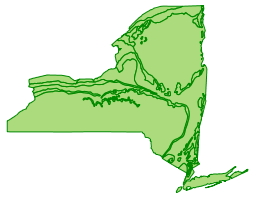
carbonate-rock aquifers 416-New York and New England carbonate-rock aquifers APPALACHIAN
PLATEAUS Permian and Pennsylvanian 310-Pennsylvanian aquifers aquifers GWA chapter HA 730-M
Name from fig 10, page M5 aq_code-aq_name -- CARBONATE-ROCK AQUIFERS New York and New
England 416-New York and New England carbonate-rock aquifers Valley and Ridge 416-New York
and New England carbonate-rock aquifers SANDSTONE AQUIFERS Mesozoic sandstone and 308-Early
Mesozoic basin basalt of the Newark aquifers Supergroup Lower Paleozoic 309-New York
sandstone aquifers CRYSTALLINE-ROCK AQUIFERS Adirondack 999-Not a principal aquifer New
England 999-Not a principal aquifer Related Spatial and Tabular Data Sets A data set showing
the extent of glacial deposits is included in the online, interactive National Atlas of the
United States, but is not available to download. This data set shows the southern limit of
glaciation in the United States; areas north of the limit line may contain significant sand
and gravel glacial deposits that are important sources of water for local areas. The final
data are being served to the public in the following formats: Arc/INFO Export, or ArcView
Shapefile. Other Online Sources of Information About Aquifers include Aquifer Basics
<
https://water.usgs.gov/ogw/aquiferbasics/index.html> provides information about the
various aquifer types; The USGS Office of Ground Water provides information about the
ground-water resources of the Nation and ground-water activities of the USGS
<
http://water.usgs.gov/ogw/>; The Ground Water Atlas of the United States
<
http://capp.water.usgs.gov/gwa/index.html>describes the location, the extent, and the
geologic and hydrologic characteristics of the important aquifers of the Nation.