
This is a human-readable view of the FGDC XML metadata.
| Name | Description | Values |
|---|---|---|
| OBJECTID | Internal feature number. | Sequential unique whole numbers that are automatically generated. |
| FNODE_ | Arc's from-node record number (Internal Software Attribute) | |
| TNODE_ | Arc's to-node record number (Internal Software Attribute) | |
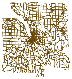
| ROADID | Unique road segement identifier. For more information, consult the Process Information under the Data Quality Section of this metadata | |
| NAME | Full commonly-used name of the road, which may or may not be the deeded name, post office name, etc. | |
| ALTNAME | Alternate, post office, tax parcel map, deeded, or local full name of the road. | |
| ROUTETYPE | Type of touring route. | coded values |
| MAINTNANCE | Primary party responsible for maintaining the road (not complete) | coded values |
| ROUTE | Federal, State, County, or Town touring route number. For multiple-routes, use a forward slash (/) between the numbers, such as 13/34. | |
| ACCESS | Type of access to the road. | coded values |
| HISTRCNAME | Previous or historical name of the road. | |
| HISTRCRTE | Previous or historic route number, including ownership, which should come first and be followed by a dash (example: 2-392 would mean an historic route of state road 392). Multiple historic routes can be listed seperated by commas. | |
| NODEA | The name of the cross street, dead end, hydrologic feature, municipal boundary, or other feature that defines the beginning of the road segment. The terms "left" and "right" are relative to viewing the road segment from beginning node (NODEA) to ending node (NODEB) | |
| NODEB | The name of the cross street, dead end, hydrologic feature, municipal boundary, or other feature that defines the end of the road segment. The terms "left" and "right" are relative to viewing the road segment from beginning node (NODEA) to ending node (NODEB). | |
| DIRECTION | Determines whether the street is one-way or bi-directional. | coded values |
| PTYPE | Pavement Type. | coded values |
| SORTORDER | Sorting order for use in ArcView and other GIS software packages that do not support many-to-one relationships for geocoding. This database must be sorted first on ROADID, then on SORTORDER for a proper relationship between it and the ROADCL data set to be established. Those address records that are most recent or most likely to represent the majority of real-world address occurences for a particular street segment are given a sort order of 1. Additional address records for the same street segment are given higher SORTORDER numbers, with the highest numbers representing the least-used real-world addresses. | |
| PREFIXDIR | Street prefix direction. | coded values |
| STREETNAME | Post office, deeded, or local street name. | |
| STREETYPE | Street type (avenue, street, road, lane, way, circle, etc.) | coded values |
| SUFFIXDIR | Street suffix direction. | coded values |
| SORTNAME | Street name that is used for sorting purposes. Prefix directions are placed last or are spelled out if they refer to places rather than direction. For example, N Cayuga Street would have a sort name of Cayuga Street N, while W Danby Rd would have a sort name of West Danby Road because West Danby is a place, not a direction. | |
| MUNICIPLTY | Municipality in which the address is located. Please note that roads that form a municipal boundary may have different names and/or addresses in each municipality. The municipality name is spelled out (eg: TOWN OF CAROLINE). | |
| SHAPE_Leng | Length of feature in internal units. | Positive real numbers that are automatically generated. |
| UPDATED | Date that the record in the GDB was last updated (User Specified). | |
| DISPLAY | Visual display of roads representing a combination of their access, routetype, and ptype, used primarily for Taxmap index and major road display. | coded values |