Stream Basins, French Creek NY, 2007

This is a human-readable view of the FGDC XML metadata.


static map preview

Identification_Information

Citation:
Citation_Information:
Originator: New York Aquatic Gap Analysis Group
Publication_Date: 2007
Title: Stream Basins, French Creek NY, 2007
Geospatial_Data_Presentation_Form: vector digital data
Publication_Information:
Publication_Place: Cornell University, Ithaca N.Y.
Publisher: New York Aquatic Gap Analysis Group
Online_Linkage: https://cugir.library.cornell.edu/catalog/cugir-007898
Description:
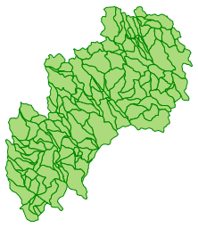
Abstract: This shapefile contains polygons representing the stream basins of the French Creek watershed in western New York. Basins were developed for stream segments at the 1:24,000 scale from 7.5 minute topographic quadrangles. For the purposes of this study, a stream segment is defined as the portion of stream from tributary confluence to tributary confluence.
Purpose: To define the drainage basin for each stream segment.
Supplemental_Information: This dataset was developed as part of the "Application of Gap Analysis to Aquatic Biodiversity Conservation", a pilot study by the New York Cooperative Fish and Wildlife Research Unit. See <http://aquagap.cfe.cornell.edu/>
Time_Period_of_Content:
Time_Period_Information:
Single_Date/Time:
Calendar_Date: 19960513
Currentness_Reference: ground condition
Status:
Progress: Complete
Maintenance_and_Update_Frequency: None planned
Spatial_Domain:
Bounding_Coordinates:
West_Bounding_Coordinate: -79.758218
East_Bounding_Coordinate: -79.520119
North_Bounding_Coordinate: 42.186643
South_Bounding_Coordinate: 41.983684
Keywords:
Theme:
Theme_Keyword_Thesaurus: None
Theme_Keyword: Basin
Theme_Keyword: Sub-Basin
Theme_Keyword: Watershed boundaries
Theme_Keyword: Sub-watershed boundaries
Theme:
Theme_Keyword_Thesaurus: LCSH
Theme_Keyword: Hydrography
Theme_Keyword: Rivers
Theme_Keyword: Watersheds
Theme:
Theme_Keyword_Thesaurus: ISO 19115 Topic Category
Theme_Keyword: environment
Theme_Keyword: inlandWaters
Theme:
Theme_Keyword_Thesaurus: CUGIR Category
Theme_Keyword: environment
Theme_Keyword: inland waters
Place:
Place_Keyword_Thesaurus: None
Place_Keyword: New York
Place_Keyword: French Creek
Place:
Place_Keyword_Thesaurus: LCSH
Place_Keyword: New York (State)
Place_Keyword: French Creek (N.Y. and Pa.)
Access_Constraints: None
Use_Constraints: Although these data have been processed successfully on a computer system at the New York Aquatic Gap Analysis Group, no warranty expressed or implied is made regarding the accuracy or utility of the data on any other system or for general or scientific purposes, nor shall the act of distribution constitute any such warranty. This disclaimer applies both to individual use of the data and aggregate use with other data. It is strongly recommended that these data are directly acquired from a New York Aquatic Gap Analysis Group server, and not indirectly through other sources which may have changed the data in some way. It is also strongly recommended that careful attention be paid to the contents of the metadata file associated with these data. The New York Aquatic Gap Analysis Group shall not be held liable for improper or incorrect use of the data described and/or contained herein.
Point_of_Contact:
Contact_Information:
Contact_Person_Primary:
Contact_Person: Marci Meixler
Contact_Organization: Cornell University
Contact_Address:
Address_Type: mailing
Address: 208 Fernow Hall
Address: Department of Natural Resources
Address: Cornell University
City: Ithaca
State_or_Province: NY
Postal_Code: 14853
Country: U.S.A.
Contact_Voice_Telephone: (607) 255-2038
Contact_Facsimile_Telephone: (607)255-1895
Contact_Electronic_Mail_Address: msm10@cornell.edu
Browse_Graphic:
Browse_Graphic_File_Name: https://cugir-data.s3.amazonaws.com/00/78/98/preview.png
Browse_Graphic_File_Description: preview of the dataset
Browse_Graphic_File_Type: PNG

Data_Quality_Information

Logical_Consistency_Report: Unknown
Completeness_Report: Unknown
Positional_Accuracy:
Horizontal_Positional_Accuracy:
Horizontal_Positional_Accuracy_Report: Positional accuracy is limited to the extent that polygons were created from hand delineation using 1:24,000-scale topographic maps.
Lineage:
Process_Step:
Process_Description: Drainage divides were hand delineated on United States Geological Survey (USGS) 1:24,000-scale topographic maps for all stream segments. Once delineated, all divides were digitized into Arc/Info. Edge matching and error correction were performed to create a single GIS map for the French Creek watershed.
Process_Date: Unknown
Process_Step:
Process_Description: CUGIR staff defined the dataset projection as UTM18N (NAD27), removed extraneous attributes, and exported the data as a shapefile.
Process_Date: 20070321

Spatial_Data_Organization_Information

Direct_Spatial_Reference_Method: Vector
Point_and_Vector_Object_Information:
SDTS_Terms_Description:
SDTS_Point_and_Vector_Object_Type: G-polygon
Point_and_Vector_Object_Count: 153

Spatial_Reference_Information

Horizontal_Coordinate_System_Definition:
Planar:
Grid_Coordinate_System:
Grid_Coordinate_System_Name: Universal Transverse Mercator
Universal_Transverse_Mercator:
UTM_Zone_Number: 18
Transverse_Mercator:
Scale_Factor_at_Central_Meridian: 0.999600
Longitude_of_Central_Meridian: -75.000000
Latitude_of_Projection_Origin: 0.000000
False_Easting: 500000.000000
False_Northing: 0.000000
Planar_Coordinate_Information:
Planar_Coordinate_Encoding_Method: coordinate pair
Coordinate_Representation:
Abscissa_Resolution: 0.000032
Ordinate_Resolution: 0.000032
Planar_Distance_Units: meters
Geodetic_Model:
Horizontal_Datum_Name: North American Datum of 1927
Ellipsoid_Name: Clarke 1866
Semi-major_Axis: 6378206.400000
Denominator_of_Flattening_Ratio: 294.978698

Entity_and_Attribute_Information

Entity_Type:
Entity_Type_Label: FrenchBas
Entity_Type_Definition: A stream basin within the French Creek watershed
Entity_Type_Definition_Source: New York Aquatic Gap Analysis Group
Attributes:
Name Description Values
AREA area of polygon, in square meters 0 to Unbounded
PERIMETER perimeter of polygon, in meters 0 to Unbounded
AquaGapID code indicating stream id number (code1) A one- to five-character sequence of digits, used to identify the basin within the French Creek watershed.

Distribution_Information

Distributor:
Contact_Information:
Contact_Organization_Primary:
Contact_Organization: Albert R. Mann Library
Contact_Address:
Address_Type: mailing and physical
Address: Cornell University
City: Ithaca
State_or_Province: New York
Postal_Code: 14853
Contact_Voice_Telephone: 607-255-5406
Contact_Electronic_Mail_Address: mann-ref@cornell.edu
Distribution_Liability: Cornell University provides these geographic data "as is". Cornell University makes no guarantee or warranty concerning the accuracy of information contained in the geographic data. Cornell University further makes no warranty either expressed or implied, regarding the condition of the product or its fitness for any particular purpose. The burden for determining fitness for use lies entirely with the user. Although these files have been processed successfully on computers at Cornell University, no warranty is made by Cornell University regarding the use of these data on any other system, nor does the fact of distribution constitute or imply any such warranty.
Standard_Order_Process:
Digital_Form:
Digital_Transfer_Information:
Format_Name: Shapefile
Format_Information_Content: zipped shapefile
File_Decompression_Technique: zip
Transfer_Size: 0.19
Digital_Transfer_Option:
Online_Option:
Computer_Contact_Information:
Network_Address:
Digital_Form:
Digital_Transfer_Information:
Format_Name: metadata
Format_Information_Content: FGDC XML metadata
Digital_Transfer_Option:
Online_Option:
Computer_Contact_Information:
Network_Address:
Digital_Form:
Digital_Transfer_Information:
Format_Name: HTML metadata
Format_Information_Content: FGDC HTML metadata
Digital_Transfer_Option:
Online_Option:
Computer_Contact_Information:
Network_Address:
Digital_Form:
Digital_Transfer_Information:
Format_Name: KML
Format_Information_Content: generated KML, via WFS
Digital_Transfer_Option:
Online_Option:
Digital_Form:
Digital_Transfer_Information:
Format_Name: GeoJSON
Format_Information_Content: generated GeoJSON, via WFS
Digital_Transfer_Option:
Online_Option:
Digital_Form:
Digital_Transfer_Information:
Format_Name: OGC:WMS
Format_Information_Content: WMS, from GeoServer
Digital_Transfer_Option:
Online_Option:
Fees: None

Metadata_Reference_Information

Metadata_Date: 20190524
Metadata_Contact:
Contact_Information:
Contact_Organization_Primary:
Contact_Organization: Albert R. Mann Library
Contact_Address:
Address_Type: mailing and physical
Address: Albert R. Mann Library
City: Ithaca
State_or_Province: New York
Postal_Code: 14853
Country: USA
Contact_Voice_Telephone: 607-255-5406
Contact_Electronic_Mail_Address: mann-ref@cornell.edu
Metadata_Standard_Name: FGDC Content Standard for Digital Geospatial Metadata
Metadata_Standard_Version: FGDC-STD-001-1998
Metadata_Time_Convention: local time