
This is a human-readable view of the FGDC XML metadata.
| Name | Description | Values |
|---|---|---|
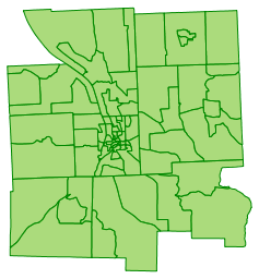
| TOWN | Town identifier; used to create a unique identifier for town and City election districts. | coded values |
| WARD | Representative ward in the City of Ithaca. | Three-digit number |
| DISTRICT | Town or City district number. | Three-digit number |
| LEGDIST | Tompkins County legislative district number | Three-digit number |
| ASMDISTNY | New York State Assembly District. | number |
| SENDISTNY | New York State Senate District. | number |
| REPDISTUS | United States House of Representatives District. | number |
| SENDISTUS | United States Senate District, as legally defined by the United States Senate. | Two-letter state code |
| DISTNAME | Name of the election district | Text string |
| ICSDELDIST | Ithaca City School District election district. | Text string |
| POP2000 | Population in each district per 2000 US Census. | 0 to Unbounded |
| ELDISTKEY | Unique identifier consisting of the Town field, the Ward field, and the District field. For Towns, the Ward is 000. For example, district 2 of ward 3 in the City of Ithaca would have an ElDistKey of 001003002, and district 1 in the Town of Enfield would have an ElDistKey of 005000001. | Text string |
| REGVOTE02 | Number of registered voters in the respective Town/City election district for 2002 (from the Tompkins County Board of Elections). | 0 to Unbounded |
| Shape_Length | Length of feature in internal units (US Survey feet). | Positive real numbers that are automatically generated. |
| Shape_Area | Area of feature in internal units squared (square US Survey feet). | Positive real numbers that are automatically generated. |