Citation:
Citation_Information:
Originator: Cornell Institute for Resource Information Sciences (Cornell IRIS)
Originator: NYS Department of Agriculture and Markets
Publication_Date: 20210430
Title: Agricultural Districts, Tioga County NY, 2021
Geospatial_Data_Presentation_Form: vector digital data
Series_Information:
Series_Name: Agricultural Districts (NYS Ag and Markets)
Issue_Identification: Tioga County
Description:
Abstract: These GIS files represent geographic boundaries for lands that are under the
protection of NYS Agricultural District Law, administered by the New York State Department
of Agriculture and Markets. The boundaries are derived from New York State Agricultural
District, 1:24,000-scale, maps produced at county agencies. The district boundaries
correspond to tax parcel data. District boundaries are joined into a file representing all
of the Agricultural Districts within an entire county. Note that 2003 legislation allows
lands to be added to districts on an annual basis. Electronic data provided here may predate
those additions. Tax parcel detail is not included in this dataset. Rights-of-way for state
and federal highways, and secondary roads, railroads and utilities are only included when they are delineated on the original 1:24,000 scale maps. The data files are in ArcGIS shapefile format.
Purpose: A Geographic Information System (ArcGIS) file intended to represent the lands within
agricultural district. Please note that boundaries may be generalizations; precise
information can be obtained from the county or town tax parcel information.
Supplemental_Information: An Agricultural District is defined by a list of tax parcels, including properties
added during the annual open enrollment. The 1:24,000-scale maps are only updated to reflect
open enrollment changes at the eight-year renewal of the district. The electronic data only
reflects changes to the 1:24,000-scale maps. The Agricultural District boundaries are for
use in conjunction with NYS geographical data (ex. NYS Department of Transportation (DOT)
7.5' planimetric data). Boundary data is current to certification date of the district map
on file at IRIS at the time the digital data was updated. The certification date is noted in
the attribute table field called "Certified". Legislation in 2003 allows lands to be added
to districts on an annual basis. Electronic data provided here may predate those additions.
Refer to the current tax parcel list for each district to confirm the precise agricultural
district boundary. For more information about NYS Agricultural Districts, see
<
https://www.agriculture.ny.gov>
Time_Period_of_Content:
Time_Period_Information:
Single_Date/Time:
Calendar_Date: 20210430
Currentness_Reference: Publication date
Status:
Progress: Complete
Maintenance_and_Update_Frequency: Periodically
Spatial_Domain:
Bounding_Coordinates:
West_Bounding_Coordinate: -76.556864
East_Bounding_Coordinate: -76.082898
North_Bounding_Coordinate: 42.407134
South_Bounding_Coordinate: 41.998333
Keywords:
Theme:
Theme_Keyword_Thesaurus: None
Theme_Keyword: New York State Agricultural District boundaries
Theme_Keyword: Agriculture and Markets
Theme_Keyword: Agricultural Districts Mapping Program
Theme:
Theme_Keyword_Thesaurus: ISO 19115 Topic Category
Theme_Keyword: farming
Theme_Keyword: planningCadastre
Theme:
Theme_Keyword_Thesaurus: CUGIR Category
Theme_Keyword: agriculture
Theme_Keyword: property
Place:
Place_Keyword_Thesaurus: LCSH
Place_Keyword: Tioga County (N.Y.)
Place:
Place_Keyword_Thesaurus: FIPS
Place_Keyword: 36107
Access_Constraints: none
Use_Constraints: 1) Refer to county tax parcel list of agricultural district properties and current
1:24,000-scale district maps in conjunction with annual open enrollment documentation on file
for confirmation of precise boundaries. 2) Please acknowledge New York State Agricultural
Districts Mapping Program as the source of the data. 3) It is important to check the
certification date, found in the attribute table field called "Certified". The district data
may have changed since the publication of this digital version. 4) These data are not to be
resold in any form.
Point_of_Contact:
Contact_Information:
Contact_Organization_Primary:
Contact_Organization: Cornell IRIS
Contact_Address:
Address_Type: mailing address
Address: 1015 Bradfield Hall
Address: Cornell University
City: Ithaca
State_or_Province: New York
Postal_Code: 14853-1901
Country: USA
Contact_Voice_Telephone: 607-255-6520 or 607-255-6529
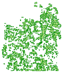
Browse_Graphic:
Browse_Graphic_File_Description: preview of the dataset
Browse_Graphic_File_Type: PNG
Data_Set_Credit: Cornell IRIS maintains the county produced Agricultural District maps on file under
contract with the New York State Department of Agriculture and Markets. In 1996 the maps on
file at Cornell IRIS (then CLEARS) were scanned at the NYSDEC as the initial step in creating
a digital database of Ag District Boundaries.
Native_Data_Set_Environment: Microsoft Windows; ArcMap v. 10.x
Attribute_Accuracy:
Attribute_Accuracy_Report: The attributes were visually compared to original source map title blocks and
confirmed against Agriculture Districts profile data provided by the Department of
Agriculture and Markets.
Logical_Consistency_Report: Boundary data reflect Agricultural District boundaries as displayed on 1:24,000-scale
maps. When boundaries show areas contained mutually in more than one district in the same
county, electronic data reflect this as an overlap. If individual tax parcels are dissolved to
form an aggregate boundary, slivers and gaps may be formed by drafting discrepancies. These
are visually compared to the map and eliminated when they do not represent intended
exclusions. If the map is unclear, the county is contacted to confirm intent. District
boundary shapefile data is printed out using DOT planimetric raster data as a base, then
proofread against the maps.
Completeness_Report: County Agricultural District boundaries are complete to the extent that the original
map is complete. Tax parcel detail is not included in this dataset. Rights-of-way for state
and federal highways, local roads, railroads and utilities are only included when they are
delineated on the original 1:24,000 scale maps. NOTE: The most current and precise boundary
of a district should be verified by referring to the tax parcel information available in the
county.
Positional_Accuracy:
Horizontal_Positional_Accuracy:
Horizontal_Positional_Accuracy_Report: Shapefiles are accurate to the quality of the original 1:24000 scale
map.
Lineage:
Source_Information:
Source_Citation:
Citation_Information:
Originator: Tioga County Planning
Publication_Date: unknown
Title: none
Source_Scale_Denominator: 24000
Type_of_Source_Media: PDF or Paper map
Source_Time_Period_of_Content:
Time_Period_Information:
Multiple_Dates/Times:
Single_Date/Time:
Calendar_Date: 20201110 (district #1)
Single_Date/Time:
Calendar_Date: 20201110 (district #2)
Single_Date/Time:
Calendar_Date: 20170508 (district #3)
Source_Currentness_Reference: 8-year certification date
Source_Citation_Abbreviation: origmaps
Source_Contribution: original district boundaries
Process_Step:
Process_Description: 1) ORIGINAL SCAN PROJECT In 1996, the entire set of NYS Agricultural District maps
in the collection of Cornell IRIS (originally CLEARS) was converted to digital format.
This was done by shipping blueprint copies of the maps to the NYS DEC for scanning.
Digital Line Graph files were returned, which were converted to ArcInfo Coverages. These
coverages represented one map sheet apiece. Original maps with multiple sheets were
represented by multiple coverages. Coverages were compared to the original maps and edited
as necessary to create an accurate representation of the Ag District boundaries shown on
the maps. After accuracy was confirmed, coverages representing multiple sheets were merged
to create district coverages. Districts were then merged to create county coverages.
Merged districts sometimes created slivers, which were eliminated, and gaps, which are
flagged with district value of zero. Overlaps between districts also occurred in a few
cases. These were flagged with district value "66". For each coverage, an attribute table
was built to record the information shown on the Cornell IRIS title block of each Ag
District hardcopy map. These tables are further described in the Entity and Attribute
Information section of the metadata.
Process_Date: 19960100 through 20010131
Process_Contact:
Contact_Information:
Contact_Organization_Primary:
Contact_Organization: Cornell IRIS
Contact_Address:
Address_Type: mailing address
Address: 1015 Bradfield Hall
Address: Cornell University
City: Ithaca
State_or_Province: New York
Postal_Code: 14853-1901
Country: USA
Contact_Voice_Telephone: 607-255-6520 or 607-255-6529
Process_Step:
Process_Description: 2) CONVERSION FROM COVERAGES TO SHAPEFILES: Internal polygons were labeled zero;
coverages were reprojected from UTMz18 NAD27 to UTMz18 NAD83; Coverages were converted to
shapefiles; zero polygons were deleted; attribute table was modified: deleted fields are
AREA, PERIMETER, FILE#, FILE_ID, AGDIST#, DOTQUADS. Modified fields are DISTCODE and
DISTRICT. DISTCODE is 12 characters to accommodate changing abbreviations -- currently
four characters and three digits to represent a key code for county name and district
number. The field DISTRICT was enlarged to accommodate district numbers up to five digits.
Also, DISTCODE, the key field, was moved to the end of the attribute table
columns.
Process_Date: 20080101 through 20080331
Process_Contact:
Contact_Information:
Contact_Organization_Primary:
Contact_Organization: Cornell IRIS
Contact_Address:
Address_Type: mailing address
Address: 1015 Bradfield Hall
Address: Cornell University
City: Ithaca
State_or_Province: New York
Postal_Code: 14853-1901
Country: USA
Contact_Voice_Telephone: 607-255-6520 or 607-255-6529
Process_Step:
Process_Description: 3) UPDATING COUNTY BOUNDARY DATA: County shapefiles are updated to reflect
modifications that occurred during the eight-year review process. Boundaries are revised
using one or more of the three methods: Tablet digitizing; On-screen digitizing; Copying
boundaries from county-supplied shapefiles. All modifications are proofread against the
original maps to confirm accuracy. Attributes are updated and checked against the
information on the map title blocks, as well as information on file. If individual tax
parcels are dissolved to form an aggregate boundary, slivers and gaps may be formed by
drafting discrepancies. These are visually compared to the map and eliminated when they do
not represent intended exclusions. Discrepancies between the title block information and
file information are clarified by contacting the county and/or New York State Department
of Agriculture and Markets.
Process_Date: 20200401 through 20210331
Process_Contact:
Contact_Information:
Contact_Organization_Primary:
Contact_Organization: Cornell IRIS
Contact_Address:
Address_Type: mailing address
Address: 1015 Bradfield Hall
Address: Cornell University
City: Ithaca
State_or_Province: New York
Postal_Code: 14853-1901
Country: USA
Contact_Voice_Telephone: 607-255-6520 or 607-255-6529
Entity_Type:
Entity_Type_Label: agricultural district
Entity_Type_Definition: Agricultural districts are lands that are under the protection of NYS Agricultural
District Law, administered by the New York State Department of Agriculture and
Markets.
Entity_Type_Definition_Source: Cornell Institute for Resource Information Sciences (Cornell IRIS)
Attributes:
| Name |
Description |
Values |
| county |
New York State county name |
NYS county names |
| district |
the agricultural district number within the county |
positive integers |
| creation |
date which the original proposed district became a legal entity |
date string |
| certified |
the most recent certified date of approval by the NYS Department of Agriculture and
Markets |
date string |
| towns |
New York State towns where district boundaries fall within |
list of NYS town names |
| distcode |
keyfield |
a four character abbreviation of the county name with a three digit district number
attached |
| OEadds303b |
list of certification dates of Open Enrollment / Annual Inclusion additions
included in the shapefile |
list of dates in text format |
Distributor:
Contact_Information:
Contact_Organization_Primary:
Contact_Organization: Albert R. Mann Library
Contact_Address:
Address_Type: mailing and physical
Address: Cornell University
City: Ithaca
State_or_Province: New York
Postal_Code: 14853
Contact_Voice_Telephone: 607-255-5406
Distribution_Liability: Cornell University provides these geographic data "as is". Cornell
University makes no guarantee or warranty concerning the accuracy of
information contained in the geographic data. Cornell University further
makes no warranty either expressed or implied, regarding the condition of
the product or its fitness for any particular purpose. The burden for
determining fitness for use lies entirely with the user. Although these
files have been processed successfully on computers at Cornell University,
no warranty is made by Cornell University regarding the use of these data
on any other system, nor does the fact of distribution constitute or imply
any such warranty.
Standard_Order_Process:
Digital_Form:
Digital_Transfer_Information:
Format_Name: Shapefile
Format_Information_Content: zipped shapefile
File_Decompression_Technique: zip
Transfer_Size: 3.46
Digital_Transfer_Option:
Online_Option:
Computer_Contact_Information:
Digital_Form:
Digital_Transfer_Information:
Format_Name: metadata
Format_Information_Content: FGDC XML metadata
Digital_Transfer_Option:
Online_Option:
Computer_Contact_Information:
Digital_Form:
Digital_Transfer_Information:
Format_Name: HTML metadata
Format_Information_Content: FGDC HTML metadata
Digital_Transfer_Option:
Online_Option:
Computer_Contact_Information:
Digital_Form:
Digital_Transfer_Information:
Format_Name: PDF
Format_Information_Content: prepared PDF map
Digital_Transfer_Option:
Online_Option:
Computer_Contact_Information:
Digital_Form:
Digital_Transfer_Information:
Format_Name: KML
Format_Information_Content: zipped KML file
Digital_Transfer_Option:
Online_Option:
Computer_Contact_Information:
Digital_Form:
Digital_Transfer_Information:
Format_Name: GeoJSON
Format_Information_Content: generated GeoJSON, via WFS
Digital_Transfer_Option:
Online_Option:
Computer_Contact_Information:
Digital_Form:
Digital_Transfer_Information:
Format_Name: OGC:WMS
Format_Information_Content: WMS, from GeoServer
Digital_Transfer_Option:
Online_Option:
Computer_Contact_Information:
Fees: None
Distributor:
Contact_Information:
Contact_Organization_Primary:
Contact_Organization: Cornell IRIS
Contact_Address:
Address_Type: mailing address
Address: 1015 Bradfield Hall
Address: Cornell University
City: Ithaca
State_or_Province: New York
Postal_Code: 14853-1901
Country: USA
Contact_Voice_Telephone: 607-255-6520 or 607-255-6529
Distribution_Liability: Cornell University provides these geographic data "as is." Cornell University makes no
guarantee or warranty concerning the accuracy of information contained in the geographic data.
Cornell University further makes no warranty either expressed or implied, regarding the
condition of the product or its fitness for any particular purpose. The burden for determining
fitness for use lies entirely with the user. Although these files have been processed
successfully on computers at Cornell University, no warranty is made by Cornell University
regarding the use of these data on any other system, nor does the fact of distribution
constitute or imply any such warranty.
Standard_Order_Process:
Non-digital_Form: Hardcopy: Paper copy
Fees: call for price
Ordering_Instructions: call Cornell IRIS 607-255-6520 or 255-6529
Metadata_Date: 20210616
Metadata_Contact:
Contact_Information:
Contact_Organization_Primary:
Contact_Organization: Albert R. Mann Library
Contact_Address:
Address_Type: mailing and physical
Address: Albert R. Mann Library
City: Ithaca
State_or_Province: New York
Postal_Code: 14853
Country: USA
Contact_Voice_Telephone: 607-255-5406
Metadata_Standard_Name: FGDC Content Standard for Digital Geospatial Metadata
Metadata_Standard_Version: FGDC-STD-001-1998
Metadata_Time_Convention: local time