Microsoft Building Footprints, Columbia County NY, 2018

This is a human-readable view of the FGDC XML metadata.


static map preview

Identification_Information

Citation:
Citation_Information:
Originator: Microsoft
Publication_Date: 20180713
Title: Microsoft Building Footprints, Columbia County NY, 2018
Edition: v1.1
Geospatial_Data_Presentation_Form: vector digital data
Series_Information:
Series_Name: Microsoft Building Footprints
Issue_Identification: Columbia County NY
Online_Linkage: https://cugir.library.cornell.edu/catalog/cugir-009042
Description:
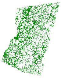
Abstract: This dataset provides a single county subset of Microsoft's computer-generated building footprints. The original footprints, covering all 50 US States, were created via a two-stage process. In the first step, semantic segmentation, a deep neural network was used to recognize building pixels on Bing aerial imagery, which is a composite of multiple sources of varying dates. In the second step, building pixels blobs were converted into polygons. It is not perfect, particularly in dense urban areas.
Purpose: This dataset provides a relatively complete dataset of building outlines, especially useful for areas where official building footprints may not exist.
Supplemental_Information: A more detailed description of the project, including evaluation metrics, can be found at https://github.com/Microsoft/USBuildingFootprints
Time_Period_of_Content:
Time_Period_Information:
Single_Date/Time:
Calendar_Date: 20180713
Currentness_Reference: Publication date
Status:
Progress: Complete
Maintenance_and_Update_Frequency: Unknown
Spatial_Domain:
Bounding_Coordinates:
West_Bounding_Coordinate: -73.919344
East_Bounding_Coordinate: -73.360248
North_Bounding_Coordinate: 42.507248
South_Bounding_Coordinate: 41.979223
Keywords:
Theme:
Theme_Keyword_Thesaurus: None
Theme_Keyword: buildings
Theme:
Theme_Keyword_Thesaurus: ISO 19115 Topic Category
Theme_Keyword: structure
Theme:
Theme_Keyword_Thesaurus: CUGIR Category
Theme_Keyword: structure
Place:
Place_Keyword_Thesaurus: None
Place_Keyword: Columbia County NY
Access_Constraints: none
Use_Constraints: This data is licensed by Microsoft under the Open Data Commons Open Database License (ODbL) https://opendatacommons.org/licenses/odbl/
Browse_Graphic:
Browse_Graphic_File_Name: https://cugir-data.s3.amazonaws.com/00/90/42/preview.png
Browse_Graphic_File_Description: preview of the dataset
Browse_Graphic_File_Type: PNG

Data_Quality_Information

Logical_Consistency_Report: Building footprint boundaries were computer-generated from pixel data, occasionally resulting in invalid polygons, which have been automatically repaired.
Completeness_Report: Based on an evaluation set of 15k buildings, precision is 99.3%, recall is 93.5%. A building was included in the county-based subset if it was at least partially within the county.
Positional_Accuracy:
Horizontal_Positional_Accuracy:
Horizontal_Positional_Accuracy_Report: Based on the evaluation set, intersection over union is 0.85, shape distance is 0.33, average rotation error is 1.6 degrees. More details at https://github.com/Microsoft/USBuildingFootprints
Lineage:
Source_Information:
Source_Citation:
Citation_Information:
Originator: Microsoft
Publication_Date: 20180713
Title: US Building Footprints, New York
Type_of_Source_Media: GeoJSON
Source_Time_Period_of_Content:
Time_Period_Information:
Single_Date/Time:
Calendar_Date: 20180713
Source_Currentness_Reference: publication date
Source_Citation_Abbreviation: NewYork.geojson
Source_Contribution: Original statewide GeoJSON file from Microsoft, consisting of 4,844,438 buildings in New York State.
Process_Step:
Process_Description: CUGIR staff fixed invalid geometries, and split the state (originally an unwieldy 1035MB GeoJSON file) into separate county shapefiles.
Process_Date: 20190612

Spatial_Data_Organization_Information

Direct_Spatial_Reference_Method: Vector
Point_and_Vector_Object_Information:
SDTS_Terms_Description:
SDTS_Point_and_Vector_Object_Type: G-polygon
Point_and_Vector_Object_Count: 41318

Spatial_Reference_Information

Horizontal_Coordinate_System_Definition:
Geographic:
Latitude_Resolution: 0.000001
Longitude_Resolution: 0.000001
Geographic_Coordinate_Units: Decimal degrees
Geodetic_Model:
Horizontal_Datum_Name: D_WGS_1984
Ellipsoid_Name: WGS_1984
Semi-major_Axis: 6378137.000000
Denominator_of_Flattening_Ratio: 298.257224

Entity_and_Attribute_Information

Entity_Type:
Entity_Type_Label: buildings
Entity_Type_Definition: buildings
Entity_Type_Definition_Source: Microsoft
Attributes:
Name Description Values
fid arbitrary feature ID integer id

Distribution_Information

Distributor:
Contact_Information:
Contact_Organization_Primary:
Contact_Organization: Albert R. Mann Library
Contact_Address:
Address_Type: mailing and physical
Address: Cornell University
City: Ithaca
State_or_Province: New York
Postal_Code: 14853
Contact_Voice_Telephone: 607-255-5406
Contact_Electronic_Mail_Address: mann-ref@cornell.edu
Distribution_Liability: Cornell University provides these geographic data "as is". Cornell University makes no guarantee or warranty concerning the accuracy of information contained in the geographic data. Cornell University further makes no warranty either expressed or implied, regarding the condition of the product or its fitness for any particular purpose. The burden for determining fitness for use lies entirely with the user. Although these files have been processed successfully on computers at Cornell University, no warranty is made by Cornell University regarding the use of these data on any other system, nor does the fact of distribution constitute or imply any such warranty.
Standard_Order_Process:
Digital_Form:
Digital_Transfer_Information:
Format_Name: Shapefile
Format_Information_Content: zipped shapefile
File_Decompression_Technique: zip
Transfer_Size: 2.93
Digital_Transfer_Option:
Online_Option:
Computer_Contact_Information:
Network_Address:
Digital_Form:
Digital_Transfer_Information:
Format_Name: metadata
Format_Information_Content: FGDC XML metadata
Digital_Transfer_Option:
Online_Option:
Computer_Contact_Information:
Network_Address:
Digital_Form:
Digital_Transfer_Information:
Format_Name: HTML metadata
Format_Information_Content: FGDC HTML metadata
Digital_Transfer_Option:
Online_Option:
Computer_Contact_Information:
Network_Address:
Digital_Form:
Digital_Transfer_Information:
Format_Name: KML
Format_Information_Content: generated KML, via WFS
Digital_Transfer_Option:
Online_Option:
Digital_Form:
Digital_Transfer_Information:
Format_Name: GeoJSON
Format_Information_Content: generated GeoJSON, via WFS
Digital_Transfer_Option:
Online_Option:
Digital_Form:
Digital_Transfer_Information:
Format_Name: OGC:WMS
Format_Information_Content: WMS, from GeoServer
Digital_Transfer_Option:
Online_Option:
Fees: None

Metadata_Reference_Information

Metadata_Date: 20190612
Metadata_Contact:
Contact_Information:
Contact_Organization_Primary:
Contact_Organization: Albert R. Mann Library
Contact_Address:
Address_Type: mailing and physical
Address: Albert R. Mann Library
City: Ithaca
State_or_Province: New York
Postal_Code: 14853
Country: USA
Contact_Voice_Telephone: 607-255-5406
Contact_Electronic_Mail_Address: mann-ref@cornell.edu
Metadata_Standard_Name: FGDC Content Standard for Digital Geospatial Metadata
Metadata_Standard_Version: FGDC-STD-001-1998
Metadata_Time_Convention: local time