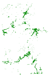
Description:
Abstract: This dataset provides a single county subset of Microsoft's computer-generated
building footprints. The original footprints, covering all 50 US States, were created via
a two-stage process. In the first step, semantic segmentation, a deep neural network was
used to recognize building pixels on Bing aerial imagery, which is a composite of multiple
sources of varying dates. In the second step, building pixels blobs were converted into
polygons. It is not perfect, particularly in dense urban areas. For the 2021 v2 release,
selected areas were updated with 2019-2020 imagery.
Purpose: This dataset provides a relatively complete dataset of building outlines, especially
useful for areas where official building footprints may not exist.
Keywords:
Theme:
Theme_Keyword_Thesaurus: None
Theme_Keyword: buildings
Theme:
Theme_Keyword_Thesaurus: ISO 19115 Topic Category
Theme_Keyword: structure
Theme:
Theme_Keyword_Thesaurus: CUGIR Category
Theme_Keyword: structure
Place:
Place_Keyword_Thesaurus: None
Place_Keyword: Hamilton County NY