Lineage:
Source_Information:
Source_Citation:
Citation_Information:
Originator: U.S. Geological Survey
Publication_Date: 20200408
Title: Landsat—Earth Observation Satellites
Geospatial_Data_Presentation_Form: publication
Other_Citation_Details: https://www.usgs.gov/core-science-systems/nli/landsat/landsat-5?qt-science_support_page_related_con=0#qt-science_support_page_related_con
Type_of_Source_Media: Digital and/or Hardcopy
Source_Time_Period_of_Content:
Time_Period_Information:
Range_of_Dates/Times:
Beginning_Date: 1984
Ending_Date: 2013
Source_Currentness_Reference: ground condition
Source_Citation_Abbreviation: Landsat TM
Source_Contribution: Landsat Thematic Mapper (TM)
Source_Information:
Source_Citation:
Citation_Information:
Originator: U.S. Geological Survey
Originator: Jon Dewitz
Publication_Date: 201901
Title: NLCD 2016 Land Cover Conterminous United States
Geospatial_Data_Presentation_Form: raster digital data
Other_Citation_Details: Yang, L., et al. (2018). "A new generation of the United States National Land Cover Database: Requirements, research priorities, design, and implementation strategies." ISPRS Journal of Photogrammetry and Remote Sensing 146: 108-123.
Type_of_Source_Media: Digital and/or Hardcopy
Source_Time_Period_of_Content:
Time_Period_Information:
Range_of_Dates/Times:
Beginning_Date: 2001
Ending_Date: 2016
Source_Currentness_Reference: ground condition
Source_Citation_Abbreviation: DEM
Source_Contribution: Digital Elevation Module (DEM)
Source_Information:
Source_Citation:
Citation_Information:
Originator: Julia A. Barsi
Originator: Brian L. Markham
Originator: Jeffrey S. Czapla-Myers
Originator: Dennis L. Helder
Originator: Simon J. Hook
Originator: John R. Schott
Originator: Md. Obaidul Haque
Publication_Date: 20160919
Title: Landsat-7 ETM+ radiometric calibration status
Geospatial_Data_Presentation_Form: publication
Other_Citation_Details: https://www.usgs.gov/core-science-systems/nli/landsat/landsat-7?qt-science_support_page_related_con=0#qt-science_support_page_related_con
Type_of_Source_Media: Digital and/or Hardcopy
Source_Time_Period_of_Content:
Time_Period_Information:
Range_of_Dates/Times:
Beginning_Date: 1999
Ending_Date: 2020
Source_Currentness_Reference: ground condition
Source_Citation_Abbreviation: Landsat ETM+
Source_Contribution: Landsat Enhanced Thematic Mapper Plus (ETM+)
Source_Information:
Source_Citation:
Citation_Information:
Originator: Cody Anderson
Originator: Dennis Helder
Originator: Drake Jeno
Publication_Date: 2017
Title: Statistical relative gain calculation for Landsat 8
Geospatial_Data_Presentation_Form: publication
Other_Citation_Details: https://www.usgs.gov/core-science-systems/nli/landsat/landsat-8?qt-science_support_page_related_con=0#qt-science_support_page_related_con
Type_of_Source_Media: Digital and/or Hardcopy
Source_Time_Period_of_Content:
Time_Period_Information:
Range_of_Dates/Times:
Beginning_Date: 2013
Ending_Date: 2020
Source_Currentness_Reference: ground condition
Source_Citation_Abbreviation: Landsat OLI
Source_Contribution: Landsat Operational Land Imager (OLI)
Source_Information:
Source_Citation:
Citation_Information:
Originator: Julia A. Barsi
Originator: Brian L. Markham
Originator: Matthew Montanaro
Originator: Aaron Gerace
Originator: Simon Hook
Originator: John R. Schott
Originator: Nina G. Raqueno
Originator: Ron Morfitt
Publication_Date: 2017
Title: Landsat-8 TIRS thermal radiometric calibration status
Geospatial_Data_Presentation_Form: publication
Other_Citation_Details: https://www.usgs.gov/core-science-systems/nli/landsat/landsat-8?qt-science_support_page_related_con=0#qt-science_support_page_related_con
Type_of_Source_Media: Digital and/or Hardcopy
Source_Time_Period_of_Content:
Time_Period_Information:
Range_of_Dates/Times:
Beginning_Date: 2013
Ending_Date: 2020
Source_Currentness_Reference: ground condition
Source_Citation_Abbreviation: Landsat TIRS
Source_Contribution: Landsat Thermal Infrared Sensor (TIRS)
Source_Information:
Source_Citation:
Citation_Information:
Originator: U.S. Geological Survey
Publication_Date: 20200408
Title: Landsat—Earth Observation Satellites
Geospatial_Data_Presentation_Form: publication
Other_Citation_Details: https://www.usgs.gov/core-science-systems/nli/landsat/landsat-5?qt-science_support_page_related_con=0#qt-science_support_page_related_con
Type_of_Source_Media: Digital and/or Hardcopy
Source_Time_Period_of_Content:
Time_Period_Information:
Range_of_Dates/Times:
Beginning_Date: 1984
Ending_Date: 2013
Source_Currentness_Reference: ground condition
Source_Citation_Abbreviation: Landsat MSS
Source_Contribution: Landsat Multispectral Scanner (MSS)
Source_Information:
Source_Citation:
Citation_Information:
Originator: U.S. Geological Survey
Originator: Jon Dewitz
Publication_Date: 201901
Title: NLCD 2016 Land Cover Conterminous United States
Geospatial_Data_Presentation_Form: raster digital data
Other_Citation_Details: Yang, L., et al. (2018). "A new generation of the United States National Land Cover Database: Requirements, research priorities, design, and implementation strategies." ISPRS Journal of Photogrammetry and Remote Sensing 146: 108-123.
Type_of_Source_Media: Digital and/or Hardcopy
Source_Time_Period_of_Content:
Time_Period_Information:
Range_of_Dates/Times:
Beginning_Date: 2001
Ending_Date: 2016
Source_Currentness_Reference: ground condition
Source_Citation_Abbreviation: USGS National Land Cover Database
Source_Contribution: United States Geological Survey (USGS) National Land Cover Database (NLCD)
Source_Information:
Source_Citation:
Citation_Information:
Originator: John L. Dwyer
Originator: David P. Roy
Originator: Brian Sauer
Originator: Calli B. Jenkerson
Originator: Hankaui K. Zhang
Originator: Leo Lymburner
Publication_Date: 20180828
Title: Analysis Ready Data: Enabling Analysis of the Landsat Archive
Geospatial_Data_Presentation_Form: publication
Other_Citation_Details: https://www.usgs.gov/core-science-systems/nli/landsat/us-landsat-analysis-ready-data?qt-science_support_page_related_con=0#qt-science_support_page_related_con
Type_of_Source_Media: Digital and/or Hardcopy
Source_Time_Period_of_Content:
Time_Period_Information:
Single_Date/Time:
Calendar_Date: 2018
Source_Currentness_Reference: ground condition
Source_Citation_Abbreviation: Landsat ARD
Source_Contribution: Landsat Analysis Ready Data (ARD)
Source_Information:
Source_Citation:
Citation_Information:
Originator: U.S. Geological Survey
Publication_Date: 2019
Title: USGS High Performance Computing (HPC) Denali system
Geospatial_Data_Presentation_Form: application/service
Type_of_Source_Media: Digital and/or Hardcopy
Source_Time_Period_of_Content:
Time_Period_Information:
Single_Date/Time:
Calendar_Date: 2019
Source_Currentness_Reference: observed
Source_Citation_Abbreviation: USGS High Performance Computing (HPC) Denali system
Source_Contribution: Two new high-performance computing (HPC) options—Denali and Tallgrass.
Source_Information:
Source_Citation:
Citation_Information:
Originator: Google
Publication_Date: 2019
Title: Google Earth Engine
Geospatial_Data_Presentation_Form: raster digital data
Type_of_Source_Media: Digital and/or Hardcopy
Source_Time_Period_of_Content:
Time_Period_Information:
Single_Date/Time:
Calendar_Date: 2019
Source_Currentness_Reference: observed
Source_Citation_Abbreviation: Google Earth Engine (GEE)
Source_Contribution: Google Earth Engine combines a multi-petabyte catalog of satellite imagery and geospatial datasets with planetary-scale analysis capabilities and makes it available for scientists, researchers, and developers to detect changes, map trends, and quantify differences on the Earth's surface.
Source_Information:
Source_Citation:
Citation_Information:
Originator: U.S. Geological Survey (USGS) National Geospatial Program
Publication_Date: 2020
Title: The 3D Elevation Program
Geospatial_Data_Presentation_Form: raster digital data
Other_Citation_Details: https://viewer.nationalmap.gov/basic/
Type_of_Source_Media: Digital and/or Hardcopy
Source_Time_Period_of_Content:
Time_Period_Information:
Range_of_Dates/Times:
Beginning_Date: 2019
Ending_Date: 2019
Source_Currentness_Reference: observed
Source_Citation_Abbreviation: 3D Elevation Program (3DEP) digital elevation data
Source_Contribution: The 3D Elevation Program is managed by the U.S. Geological Survey (USGS) National Geospatial Program to respond to growing needs for high-quality topographic data and for a wide range of other three-dimensional (3D) representations of the Nation's natural and constructed features.
Source_Information:
Source_Citation:
Citation_Information:
Originator: U.S. Department of Agriculture (USDA) National Agricultural Statistics Service (NASS)
Publication_Date: 2017
Title: Cropland Data Layer
Geospatial_Data_Presentation_Form: raster digital data
Other_Citation_Details: https://nassgeodata.gmu.edu/CropScape/
Type_of_Source_Media: Digital and/or Hardcopy
Source_Time_Period_of_Content:
Time_Period_Information:
Range_of_Dates/Times:
Beginning_Date: 2008
Ending_Date: 2017
Source_Currentness_Reference: observed
Source_Citation_Abbreviation: Cropland Data Layer (CDL)
Source_Contribution: Data on cultivated crops and confidence indices, available annually for 2008 to 2017 from the U.S. Department of Agriculture (USDA) National Agricultural Statistics Service (NASS).
Source_Information:
Source_Citation:
Citation_Information:
Originator: U.S. Fish and Wildlife Service
Publication_Date: 2021
Title: National Wetlands Inventory
Geospatial_Data_Presentation_Form: vector digital data
Other_Citation_Details: https://www.fws.gov/wetlands/Data/Web-Map-Services.html
Type_of_Source_Media: Digital and/or Hardcopy
Source_Time_Period_of_Content:
Time_Period_Information:
Range_of_Dates/Times:
Beginning_Date: 1977
Ending_Date: 2021
Source_Currentness_Reference: observed
Source_Citation_Abbreviation: National Wetlands Inventory (NWI)
Source_Contribution: The U.S. Fish and Wildlife Service's National Wetlands Inventory (NWI) provides detailed information on the abundance, characteristics, and distribution of wetlands in the United States.
Source_Information:
Source_Citation:
Citation_Information:
Originator: National Cooperative Soil Survey
Publication_Date: 2019
Title: Soil Survey Geographic (SSURGO) Database
Geospatial_Data_Presentation_Form: vector digital data
Type_of_Source_Media: Digital and/or Hardcopy
Source_Time_Period_of_Content:
Time_Period_Information:
Single_Date/Time:
Calendar_Date: 2019
Source_Currentness_Reference: observed
Source_Citation_Abbreviation: Soil Survey Geographic (SSURGO) Database
Source_Contribution: The SSURGO database contains information about soil as collected by the National Cooperative Soil Survey. The information was collected in map units at scales ranging from 1:12,000 to 1:63,360. SSURGO datasets consist of map data, tabular data, and information about how the maps and tables were created.
Source_Information:
Source_Citation:
Citation_Information:
Originator: USDA Natural Resources Conservation Service (NRCS)
Publication_Date: 2019
Title: State Soil Geographic (STATSGO2) Database
Geospatial_Data_Presentation_Form: vector digital data
Type_of_Source_Media: Digital and/or Hardcopy
Source_Time_Period_of_Content:
Time_Period_Information:
Single_Date/Time:
Calendar_Date: 2019
Source_Currentness_Reference: observed
Source_Citation_Abbreviation: State Soil Geographic (STATSGO2) Database
Source_Contribution: The USDA Natural Resources Conservation Service (NRCS) STATSGO2 database is a broad-based inventory of soils and non-soil areas, and is designed for broad planning and management uses covering state, regional, and multi-state areas.
Source_Information:
Source_Citation:
Citation_Information:
Originator: U.S. Geological Survey
Publication_Date: 2019
Title: Multi-Index Integrated Change Analysis (MIICA)
Geospatial_Data_Presentation_Form: application/service
Other_Citation_Details: Jin, Suming & Yang, Limin & Xian, G. & Danielson, P. & Homer, Collin. (2010). A Multi-Index Integrated Change Detection Method for Updating the National Land Cover Database. AGU Fall Meeting Abstracts.
Type_of_Source_Media: Digital and/or Hardcopy
Source_Time_Period_of_Content:
Time_Period_Information:
Range_of_Dates/Times:
Beginning_Date: 2001
Ending_Date: 2019
Source_Currentness_Reference: observed
Source_Citation_Abbreviation: Multi-Index Integrated Change Analysis (MIICA)
Source_Contribution: To improve the NLCD 2006 operational process, we developed a Multi-Index Integrated Change Analysis (MIICA) method at the laterstage of the NLCD 2006 project to alleviate commission and omission errors by using four spectral indices that complement each other. In addition to change location, the MIICA also generates change direction information.
Source_Information:
Source_Citation:
Citation_Information:
Originator: USDA Forest Service
Publication_Date: 2019
Title: Vegetation Change Tracker (VCT) software
Geospatial_Data_Presentation_Form: application/service
Type_of_Source_Media: Digital and/or Hardcopy
Source_Time_Period_of_Content:
Time_Period_Information:
Range_of_Dates/Times:
Beginning_Date: 1986
Ending_Date: 2008
Source_Currentness_Reference: observed
Source_Citation_Abbreviation: Vegetation Change Tracker (VCT)
Source_Contribution: Disturbance and regrowth are vital processes in determining the roles of forest ecosystem in the carbon and biogeochemical cycles. Using time series observations, the vegetation change tracker (VCT) algorithm was designed to map the location, timing, and spectral magnitudes of forest disturbance events.
Source_Information:
Source_Citation:
Citation_Information:
Originator: NOAA Office for Coastal Management
Publication_Date: 2019
Title: Coastal Change Analysis Program (C-CAP)
Geospatial_Data_Presentation_Form: application/service
Type_of_Source_Media: Digital and/or Hardcopy
Source_Time_Period_of_Content:
Time_Period_Information:
Single_Date/Time:
Calendar_Date: 2019
Source_Currentness_Reference: observed
Source_Citation_Abbreviation: C-CAP land cover
Source_Contribution: This online data viewer provides user-friendly access to coastal land cover and land cover change information developed through NOAA's Coastal Change Analysis Program (C-CAP).
Source_Information:
Source_Citation:
Citation_Information:
Originator: United States Department of Agriculture (USDA)
Originator: National Agricultural Statistics Service (NASS)
Publication_Date: 2019
Title: Cropland Data Layer
Geospatial_Data_Presentation_Form: raster digital data
Type_of_Source_Media: Digital and/or Hardcopy
Source_Time_Period_of_Content:
Time_Period_Information:
Range_of_Dates/Times:
Beginning_Date: 2008
Ending_Date: 2019
Source_Currentness_Reference: observed
Source_Citation_Abbreviation: cultivated cropland 2008 to 2019 dataset
Source_Contribution: The USDA, NASS Cropland Data Layer (CDL) is a raster, geo-referenced, crop-specific land cover data layer.
Source_Information:
Source_Citation:
Citation_Information:
Originator: USDA Natural Resources Conservation Service
Publication_Date: 2019
Title: Hydric Soils database
Geospatial_Data_Presentation_Form: vector digital data
Type_of_Source_Media: Digital and/or Hardcopy
Source_Time_Period_of_Content:
Time_Period_Information:
Single_Date/Time:
Calendar_Date: 2019
Source_Currentness_Reference: observed
Source_Citation_Abbreviation: hydric soils dataset
Source_Contribution: Hydric soils are defined as those soils that are sufficiently wet in the upper part to develop anaerobic conditions during the growing season. The Hydric Soils section presents the most current information about hydric soils. The lists of hydric soils were created by using National Soil Information System (NASIS) database selection criteria that were developed by the National Technical Committee for Hydric Soils.
Source_Information:
Source_Citation:
Citation_Information:
Originator: RuleQuest
Publication_Date: 2019
Title: See5 decision tree classification software
Geospatial_Data_Presentation_Form: application/service
Other_Citation_Details: https://www.rulequest.com/see5-info.html
Type_of_Source_Media: Digital and/or Hardcopy
Source_Time_Period_of_Content:
Time_Period_Information:
Range_of_Dates/Times:
Beginning_Date: 1986
Ending_Date: 2019
Source_Currentness_Reference: observed
Source_Citation_Abbreviation: See5
Source_Contribution: See5 (Windows 8/10) and its Linux counterpart C5.0 are sophisticated data mining tools for discovering patterns that delineate categories, assembling them into classifiers, and using them to make predictions. The See5 decision tree classification software was run on the training samples to generate a set of rules, and the decision rules were applied to generate a land cover classification for each of the eight target years. The See5® software was run with four sets of independent variables: the 1986 to 2019 disturbance year data derived from VCT; the set of Landsat images; compactness indices from image segmentation; and a DEM and its derivatives.
Process_Step:
Process_Description: The National Land Cover Database (NLCD) is fundamentally based on the analysis of Landsat data. In previous NLCD product generation, we used individual Landsat scenes for our imagery. For NLCD 2019, we used composite images rather than individual scenes. Compositing made imagery generation more automated, reduced latency, and increased the mapping extent. For the mapping extent for NLCD 2019, we divided CONUS into 50 blocks, each containing approximately 9 path/rows.
Source_Used_Citation_Abbreviation: Landsat MSS
Source_Used_Citation_Abbreviation: Landsat TM
Source_Used_Citation_Abbreviation: DEM
Source_Used_Citation_Abbreviation: Landsat ETM+
Source_Used_Citation_Abbreviation: Landsat OLI
Source_Used_Citation_Abbreviation: Landsat TIRS
Source_Used_Citation_Abbreviation: Landsat ARD
Process_Date: 2019
Source_Produced_Citation_Abbreviation: USGS National Land Cover Database
Process_Contact:
Contact_Information:
Contact_Person_Primary:
Contact_Person: Jon Dewitz
Contact_Organization: U.S. Geological Survey, LAND RESOURCES
Contact_Position: GEOGRAPHER
Contact_Address:
Address_Type: mailing address
Address: 47914 252Nd Street
City: Sioux Falls
State_or_Province: SD
Postal_Code: 57198
Country: US
Contact_Voice_Telephone: 605-594-2715
Process_Step:
Process_Description: For compositing, we generated 2014, 2016, and 2019 leaf-on, leaf-off, and reference composite using Analysis Ready Data (ARD) Surface Reflectance data. The leaf-on composite used data from May 1 to September 30. The leaf-off composite used data from November 1 through April 1. Finally, for reference we generated a 16-month composite image. Each composite that was generated used the Euclidean norm, which is the sum of the squares for each observation. We took the Euclidean norm across the individual band differences from their respective medians; the observation with the closest per-band median values for all six bands in the ARD composite is the actual surface reflectance value.
Source_Used_Citation_Abbreviation: Landsat ARD
Process_Date: 2019
Source_Produced_Citation_Abbreviation: USGS National Land Cover Database
Process_Contact:
Contact_Information:
Contact_Person_Primary:
Contact_Person: Jon Dewitz
Contact_Organization: U.S. Geological Survey, CORE SCIENCE SYSTEMS
Contact_Position: GEOGRAPHER
Contact_Address:
Address_Type: mailing address
Address: 47914 252Nd Street
City: Sioux Falls
State_or_Province: SD
Postal_Code: 57198
Country: US
Contact_Voice_Telephone: 605-594-2715
Process_Step:
Process_Description: With each composite we generated a date image based on the ARD observation used for that date. In addition, we generated a clear image from the observations that were flagged as either water or clear by FMask or pixel quality information. To reduce latency, we generated the composites using the USGS High Performance Computing (HPC) Denali system.
Source_Used_Citation_Abbreviation: Landsat ARD
Source_Used_Citation_Abbreviation: USGS High Performance Computing (HPC) Denali system
Process_Date: 2019
Source_Produced_Citation_Abbreviation: USGS National Land Cover Database
Process_Contact:
Contact_Information:
Contact_Person_Primary:
Contact_Person: Jon Dewitz
Contact_Organization: U.S. Geological Survey, CORE SCIENCE SYSTEMS
Contact_Position: GEOGRAPHER
Contact_Address:
Address_Type: mailing address
Address: 47914 252Nd Street
City: Sioux Falls
State_or_Province: SD
Postal_Code: 57198
Country: US
Contact_Voice_Telephone: 605-594-2715
Process_Step:
Process_Description: Once generated, each leaf-on and leaf-off composite was then screened and masked for additional clouds, shadows, and poorly filled areas that were missed by FMask or pixel quality information For each block, we also evaluated the ARD reference composite—if that composite had any zeros in the bands, we filled in those areas with a 16-month reference surface reflectance composite, which was generated from Google Earth Engine (GEE), and produced a final reference composite. This composite is based on the image cloud cover percentage that is less than 30 percent. For each block we created a final leaf-on/leaf-off composite. If an ARD composite had no mask, the ARD composite was the final composite. If the ARD composite had areas that were masked, the leaf-on/leaf-off composite used the final reference composite to fill in those areas to create the final composite.
Source_Used_Citation_Abbreviation: Landsat ARD
Source_Used_Citation_Abbreviation: Google Earth Engine (GEE)
Process_Date: 2019
Source_Produced_Citation_Abbreviation: USGS National Land Cover Database
Process_Contact:
Contact_Information:
Contact_Person_Primary:
Contact_Person: Jon Dewitz
Contact_Organization: U.S. Geological Survey, CORE SCIENCE SYSTEMS
Contact_Position: GEOGRAPHER
Contact_Address:
Address_Type: mailing address
Address: 47914 252Nd Street
City: Sioux Falls
State_or_Province: SD
Postal_Code: 57198
Country: US
Contact_Voice_Telephone: 605-594-2715
Process_Step:
Process_Description: At this point, mappers evaluated the final composites, and if they found any additional areas that needed to be masked out, they updated the masks and created new final composites. Other datasets used as direct input into classifier along with the Landsat composites are: all NLCD land cover products produced for the 2019 edition; 3D Elevation Program (3DEP) digital elevation data; Cropland Data Layer (CDL); National Wetlands Inventory (NWI); Soil Survey Geographic (SSURGO) Database; and State Soil Geographic (STATSGO2) Database. SSURGO (with STATSGO2 to fill in gaps) was the basis for a hydric soils data layer used in training data assembly.
Source_Used_Citation_Abbreviation: 3D Elevation Program (3DEP) digital elevation data
Source_Used_Citation_Abbreviation: Cropland Data Layer (CDL)
Source_Used_Citation_Abbreviation: National Wetlands Inventory (NWI)
Source_Used_Citation_Abbreviation: Soil Survey Geographic (SSURGO) Database
Source_Used_Citation_Abbreviation: State Soil Geographic (STATSGO2) Database
Process_Date: 2019
Source_Produced_Citation_Abbreviation: USGS National Land Cover Database
Process_Contact:
Contact_Information:
Contact_Person_Primary:
Contact_Person: Jon Dewitz
Contact_Organization: U.S. Geological Survey, CORE SCIENCE SYSTEMS
Contact_Position: GEOGRAPHER
Contact_Address:
Address_Type: mailing address
Address: 47914 252Nd Street
City: Sioux Falls
State_or_Province: SD
Postal_Code: 57198
Country: US
Contact_Voice_Telephone: 605-594-2715
Process_Step:
Process_Description: NLCD 2019 was produced by modeling land cover change over eight intervals between 2001 and 2019, with consistent change trajectories built into the process. The first set of models in this process are for multi-spectral change detection. The Multi-Index Integrated Change Analysis (MIICA) model outputs a change map between two dates of imagery. Five spectral indices are also calculated, and a disturbance map is produced by the Vegetation Change Tracker (VCT) software. The MIICA outputs, the five spectral indices, and the 1986 to 2019 disturbance map are the inputs to the training dataset assembly stage.
Source_Used_Citation_Abbreviation: Multi-Index Integrated Change Analysis (MIICA)
Source_Used_Citation_Abbreviation: Vegetation Change Tracker (VCT)
Process_Date: 2019
Source_Produced_Citation_Abbreviation: USGS National Land Cover Database
Process_Contact:
Contact_Information:
Contact_Person_Primary:
Contact_Person: Jon Dewitz
Contact_Organization: U.S. Geological Survey, CORE SCIENCE SYSTEMS
Contact_Position: GEOGRAPHER
Contact_Address:
Address_Type: mailing address
Address: 47914 252Nd Street
City: Sioux Falls
State_or_Province: SD
Postal_Code: 57198
Country: US
Contact_Voice_Telephone: 605-594-2715
Process_Step:
Process_Description: Because 2019 imagery is based upon composites, and 2001 to 2016 were previously based upon single date path rows, a bridge between these two types of imagery was needed. All preprocessing, change trajectory, and spectral indices follow the same logic as the 2001 to 2016 process. However, since the 2001 to 2016 process used static dates that could be a year prior or post the of the target year (for example, both 2015 and 2017 images were used over about 1/5 of the United States for the 2016 target year), overlap between this type of imagery was as needed. Composites were made for leaf on and leaf off in 2014, 2016, and 2019. The 2014 and 2016 images dovetail with the path row imagery previously used. This allows alignment of change dates where needed. It also provides similar imagery where comparisons between pre-and post dates for change (2014 to 2016, or 2016 to 2019) are essential. The use of the same style change pairs ensures proper phenological matches and similar spectral properties.
Source_Used_Citation_Abbreviation: Landsat MSS
Source_Used_Citation_Abbreviation: Landsat TM
Source_Used_Citation_Abbreviation: DEM
Source_Used_Citation_Abbreviation: Landsat ETM+
Source_Used_Citation_Abbreviation: Landsat OLI
Source_Used_Citation_Abbreviation: Landsat TIRS
Source_Used_Citation_Abbreviation: Landsat ARD
Process_Date: 2019
Source_Produced_Citation_Abbreviation: USGS National Land Cover Database
Process_Contact:
Contact_Information:
Contact_Person_Primary:
Contact_Person: Jon Dewitz
Contact_Organization: U.S. Geological Survey, CORE SCIENCE SYSTEMS
Contact_Position: GEOGRAPHER
Contact_Address:
Address_Type: mailing address
Address: 47914 252Nd Street
City: Sioux Falls
State_or_Province: SD
Postal_Code: 57198
Country: US
Contact_Voice_Telephone: 605-594-2715
Process_Step:
Process_Description: The set of models previously developed to assemble a training dataset for each land cover class for the 2001 to 2016 process was repeated for 2014 to 2016, and 2016 to 2019. The training dataset models were built with Landsat images and derived indices, spectral change products, trajectory analysis, and ancillary data: previous years' NLCD land cover; C-CAP land cover; CDL; NWI; a cultivated cropland 2008 to 2019 dataset; and a hydric soils dataset . Image segmentation, using Ecognition, was performed on the Landsat scenes and composites, and the resulting image objects were used to mitigate noise in the training data. The final output of this stage is training data for each of the target years, used as input into the initial land cover classification stage.
Source_Used_Citation_Abbreviation: C-CAP land cover
Source_Used_Citation_Abbreviation: Cropland Data Layer (CDL)
Source_Used_Citation_Abbreviation: National Wetlands Inventory (NWI)
Source_Used_Citation_Abbreviation: cultivated cropland 2008 to 2019 dataset
Source_Used_Citation_Abbreviation: hydric soils dataset
Process_Date: 2019
Source_Produced_Citation_Abbreviation: USGS National Land Cover Database
Process_Contact:
Contact_Information:
Contact_Person_Primary:
Contact_Person: Jon Dewitz
Contact_Organization: U.S. Geological Survey, CORE SCIENCE SYSTEMS
Contact_Position: GEOGRAPHER
Contact_Address:
Address_Type: mailing address
Address: 47914 252Nd Street
City: Sioux Falls
State_or_Province: SD
Postal_Code: 57198
Country: US
Contact_Voice_Telephone: 605-594-2715
Process_Step:
Process_Description: For each of the eight target years of Landsat data, two percent of all available training data per path/row was drawn from the data as training samples, and one percent was drawn as validation samples. The See5 decision tree classification software was run on the training samples to generate a set of rules, and the decision rules were applied to generate a land cover classification for each of the eight target years.
The See5 software was run with four sets of independent variables: the 1986 to 2019 disturbance year data derived from VCT; the set of Landsat images; compactness indices from image segmentation; and a DEM and its derivatives.
Source_Used_Citation_Abbreviation: See5
Source_Used_Citation_Abbreviation: Vegetation Change Tracker (VCT)
Source_Used_Citation_Abbreviation: Landsat ARD
Source_Used_Citation_Abbreviation: DEM
Process_Date: 2019
Source_Produced_Citation_Abbreviation: USGS National Land Cover Database
Process_Contact:
Contact_Information:
Contact_Person_Primary:
Contact_Person: Jon Dewitz
Contact_Organization: U.S. Geological Survey, CORE SCIENCE SYSTEMS
Contact_Position: GEOGRAPHER
Contact_Address:
Address_Type: mailing address
Address: 47914 252Nd Street
City: Sioux Falls
State_or_Province: SD
Postal_Code: 57198
Country: US
Contact_Voice_Telephone: 605-594-2715
Process_Step:
Process_Description: The classifier was run twice, once with all land cover classes processed and the 1986 to 2019 disturbance year data included, and again with two classes - Urban and Water - omitted from the classification and the disturbance year data not included in processing as these classes have separate process steps. Urban is directly derived from percent impervious, and water is directly derived from the first classification and derived water indices from Landsat data to remove areas of spectral confusion such as shadows and deep forest.
Source_Used_Citation_Abbreviation: Landsat MSS
Source_Used_Citation_Abbreviation: Landsat TM
Source_Used_Citation_Abbreviation: DEM
Source_Used_Citation_Abbreviation: Landsat ETM+
Source_Used_Citation_Abbreviation: Landsat OLI
Source_Used_Citation_Abbreviation: Landsat TIRS
Source_Used_Citation_Abbreviation: Landsat ARD
Process_Date: 2019
Source_Produced_Citation_Abbreviation: USGS National Land Cover Database
Process_Contact:
Contact_Information:
Contact_Person_Primary:
Contact_Person: Jon Dewitz
Contact_Organization: U.S. Geological Survey, CORE SCIENCE SYSTEMS
Contact_Position: GEOGRAPHER
Contact_Address:
Address_Type: mailing address
Address: 47914 252Nd Street
City: Sioux Falls
State_or_Province: SD
Postal_Code: 57198
Country: US
Contact_Voice_Telephone: 605-594-2715
Process_Step:
Process_Description: The two classifications were processed with ancillary data and the segmentation polygons to produce eight initial land cover maps.
Process_Date: 2019
Source_Produced_Citation_Abbreviation: USGS National Land Cover Database
Process_Contact:
Contact_Information:
Contact_Person_Primary:
Contact_Person: Jon Dewitz
Contact_Organization: U.S. Geological Survey, CORE SCIENCE SYSTEMS
Contact_Position: GEOGRAPHER
Contact_Address:
Address_Type: mailing address
Address: 47914 252Nd Street
City: Sioux Falls
State_or_Province: SD
Postal_Code: 57198
Country: US
Contact_Voice_Telephone: 605-594-2715
Process_Step:
Process_Description: A post-classification refinement process was developed to correct classification errors in each target year, check for consistency of land cover labels over time, and improve spatial coherence of land cover distribution. Refinement was conducted class-by-class in hierarchical order: (1) Water, (2) Wetlands, (3) Forest and forest transition, (4) Permanent snow, (5) Agricultural lands, and (6) Persistent shrubland and herbaceous. Models were developed for refinement of each class and each type of confusion. For example, confusion between coniferous forest and water, both spectrally "dark" could be corrected by reclassifying water to coniferous forest where slope was greater than 2 percent. Confusion between forest and cropland could be mitigated with CDL data, and so forth.
Source_Used_Citation_Abbreviation: Cropland Data Layer (CDL)
Process_Date: 2019
Source_Produced_Citation_Abbreviation: USGS National Land Cover Database
Process_Contact:
Contact_Information:
Contact_Person_Primary:
Contact_Person: Jon Dewitz
Contact_Organization: U.S. Geological Survey, CORE SCIENCE SYSTEMS
Contact_Position: GEOGRAPHER
Contact_Address:
Address_Type: mailing address
Address: 47914 252Nd Street
City: Sioux Falls
State_or_Province: SD
Postal_Code: 57198
Country: US
Contact_Voice_Telephone: 605-594-2715
Process_Step:
Process_Description: The final integration step resolved class label issues pertinent to local environments (such as coastal areas), and, for land cover classes other than Water (which is directly derived from a combination of Landsat indices and initial classifications) and Developed (which is directly derived from percent developed impervious surface), ensured that all pixels in a segmentation object were in the same class. Pixel-based and object-based land cover labels were checked for differences, which were reconciled by a rule-based model. Water and Developed classes kept pixel values intact even in areas that were smaller than segmentation objects. Change trajectories for each class were checked for consistency through all years.
Source_Used_Citation_Abbreviation: Landsat MSS
Source_Used_Citation_Abbreviation: Landsat TM
Source_Used_Citation_Abbreviation: DEM
Source_Used_Citation_Abbreviation: Landsat ETM+
Source_Used_Citation_Abbreviation: Landsat OLI
Source_Used_Citation_Abbreviation: Landsat TIRS
Source_Used_Citation_Abbreviation: Landsat ARD
Process_Date: 2019
Source_Produced_Citation_Abbreviation: USGS National Land Cover Database
Process_Contact:
Contact_Information:
Contact_Person_Primary:
Contact_Person: Jon Dewitz
Contact_Organization: U.S. Geological Survey, CORE SCIENCE SYSTEMS
Contact_Position: GEOGRAPHER
Contact_Address:
Address_Type: mailing address
Address: 47914 252Nd Street
City: Sioux Falls
State_or_Province: SD
Postal_Code: 57198
Country: US
Contact_Voice_Telephone: 605-594-2715
Process_Step:
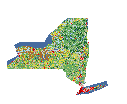
Process_Description: CUGIR staff clipped data to New York state boundary, converted to GeoTIFF, and defined CRS as EPSG:5070
Process_Date: 20221102